To get your daily forecast delivered free goto http://wallysweather.com.au/blog
An added thanks to the sponsorship from NQ Licensed Events and the Country Festival on March 30 & 31 at the Dittman Bullpit
Website: https://www.countryfest.com.au/
Facebook: https://www.facebook.com/contryfestqld
Instagram: https://www.instagram.com/countryfestqld/
National
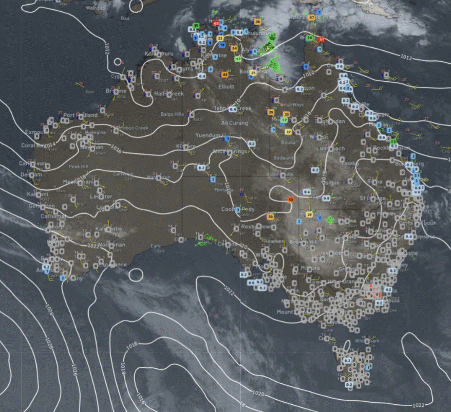
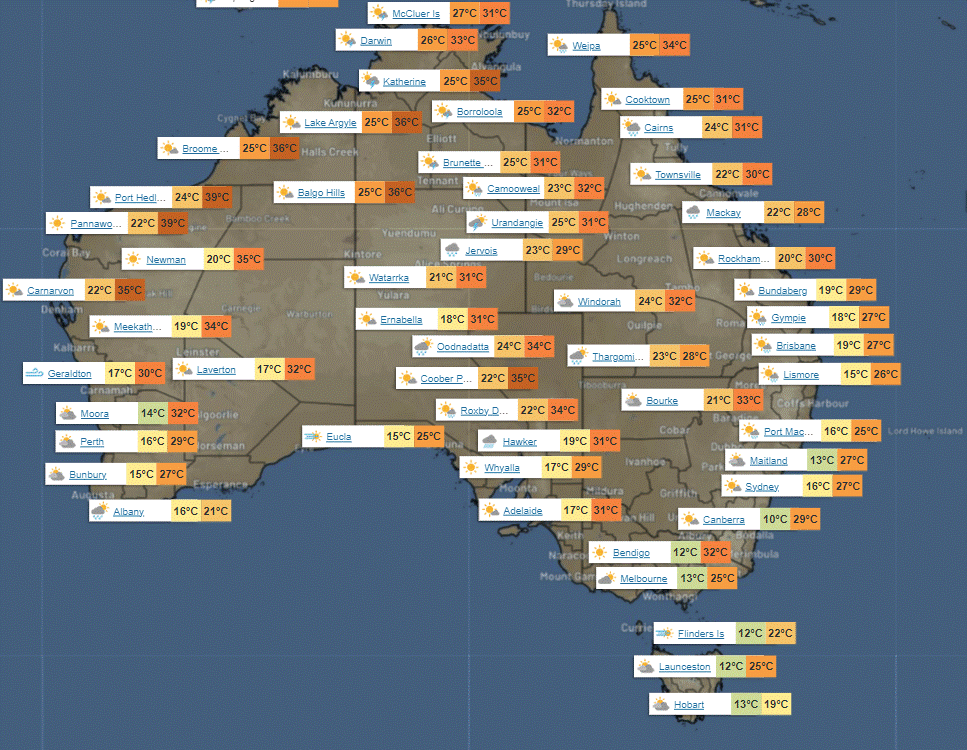
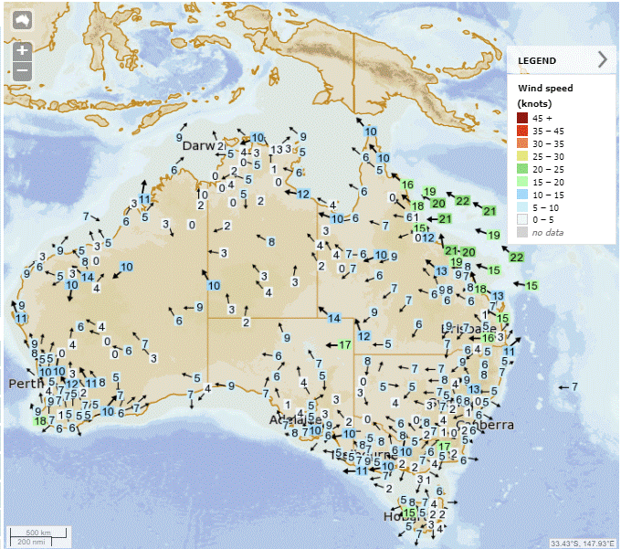
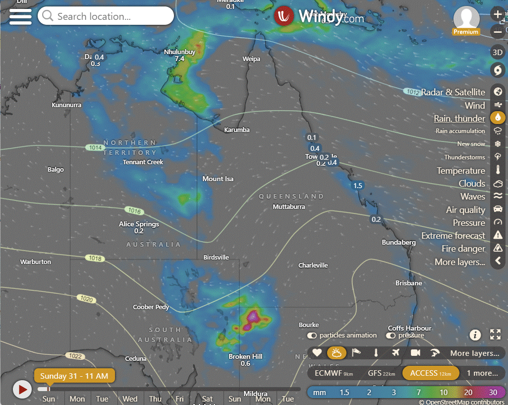
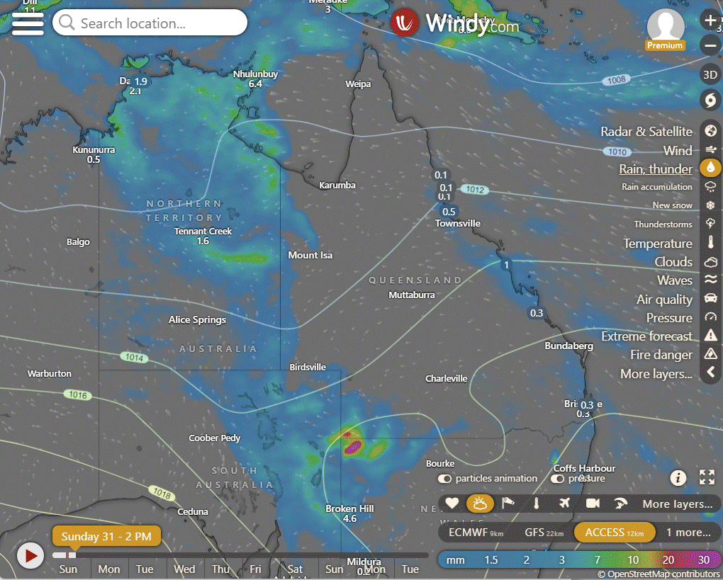
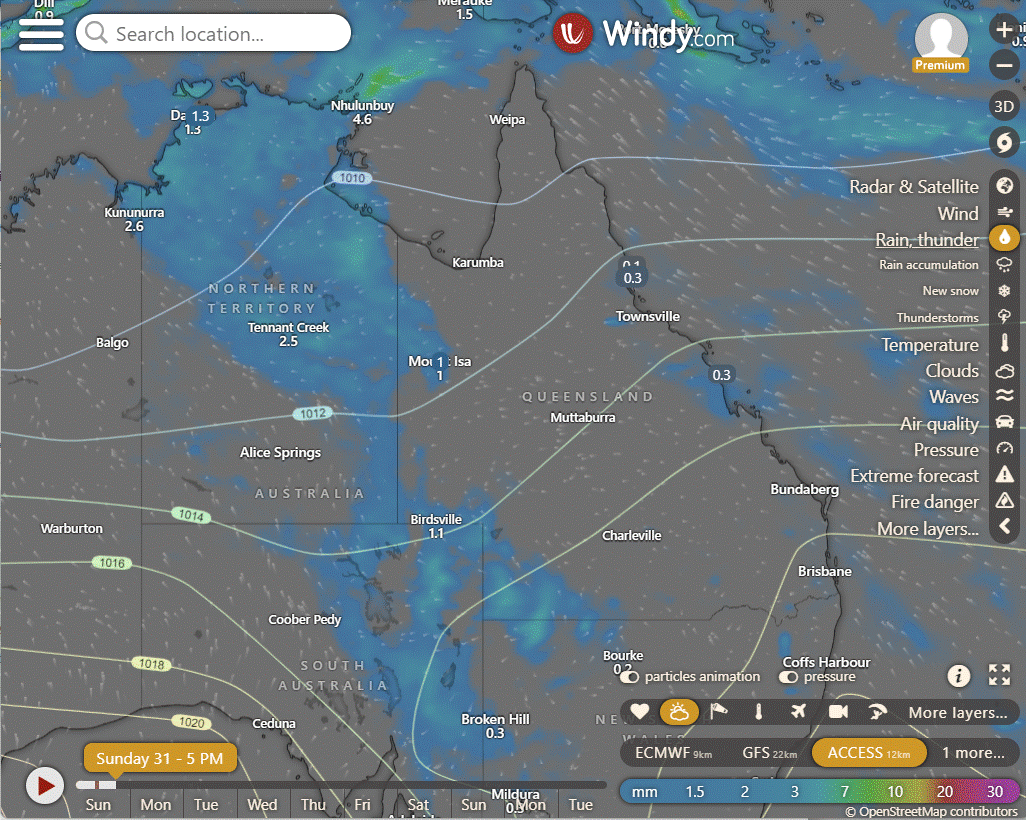
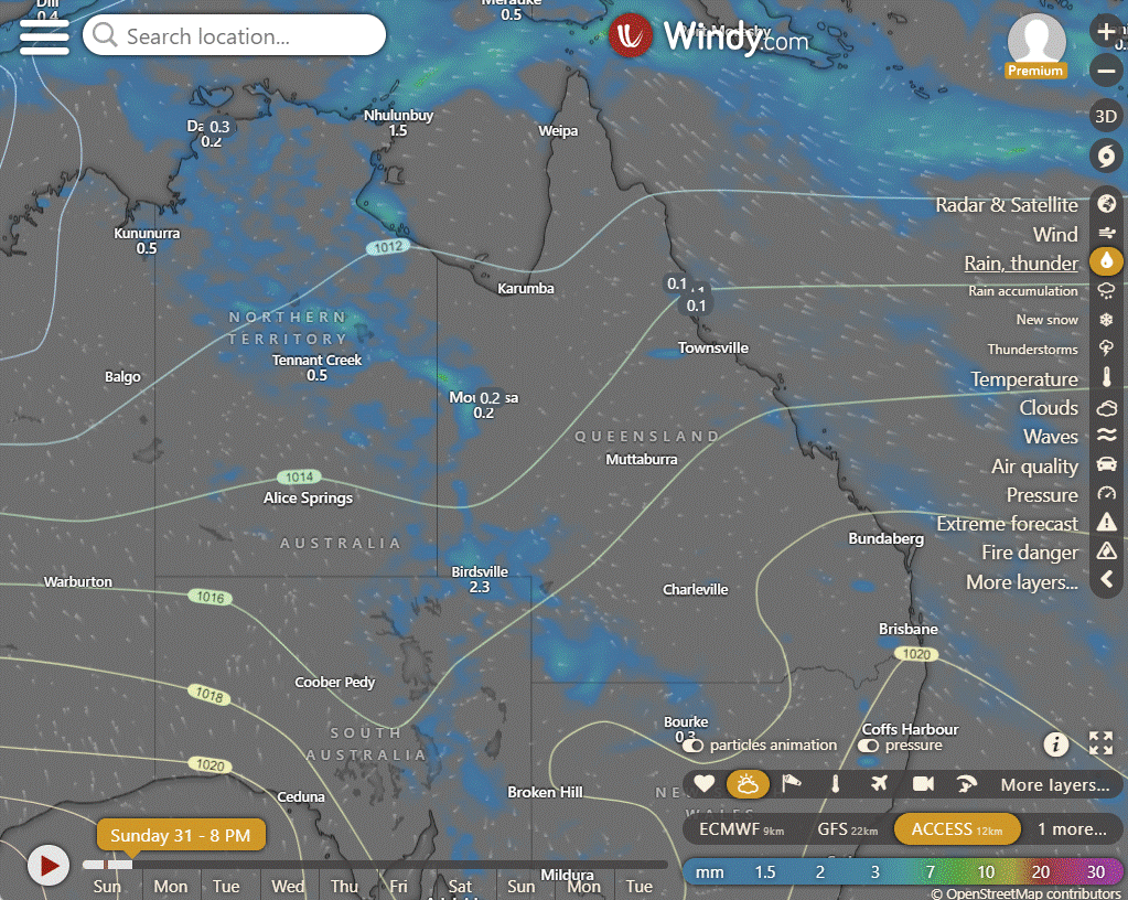
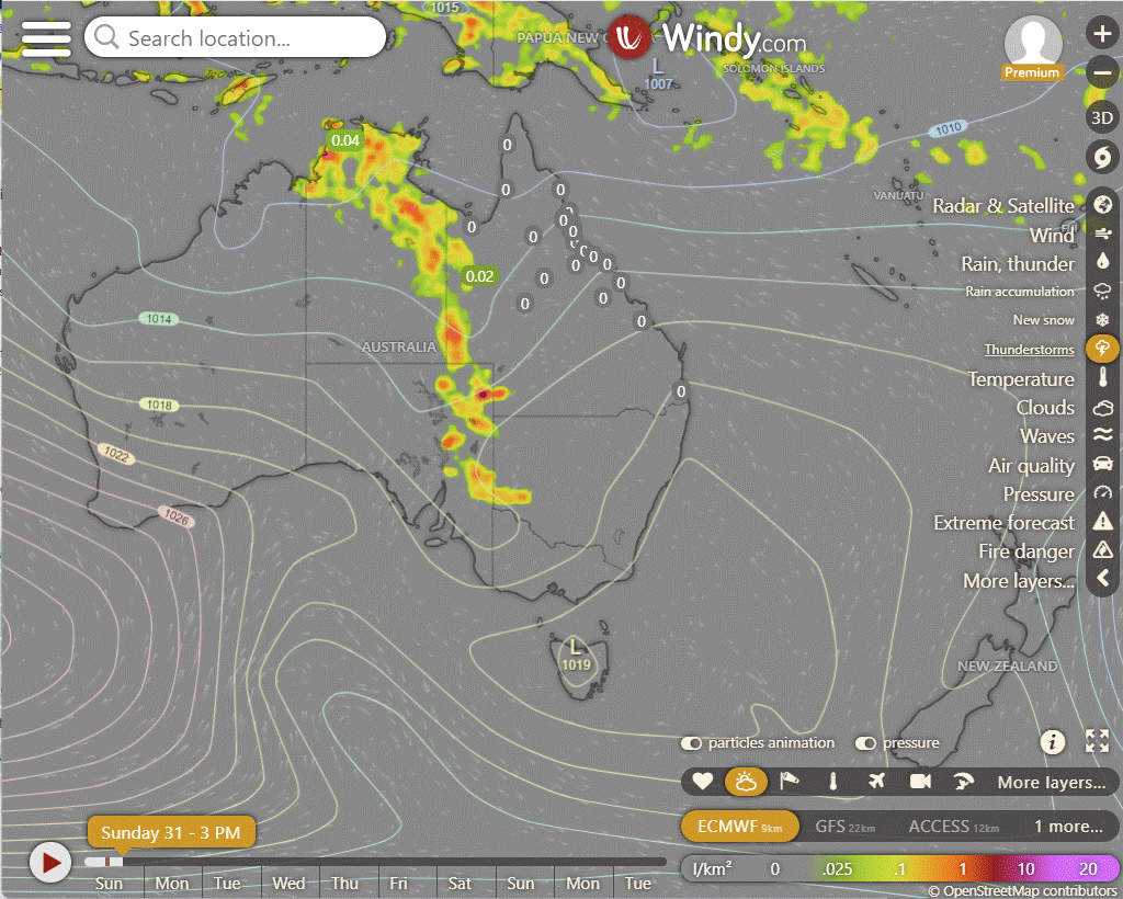
In humid and unstable winds, expect showers and storms across northeastern WA, northern SA, the NT, western QLD, and northwest NSW. Heavy rainfall is possible. Along the coasts of QLD, northern NSW, and southwest WA, showers are forecasted due to cooling southeasterly winds. Dry conditions are expected elsewhere, thanks to high pressure.
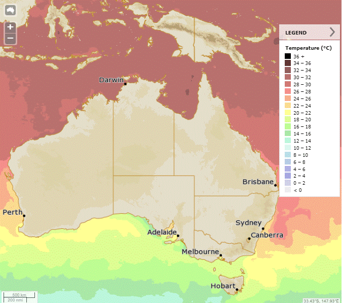
Synoptic | Temp/Rain | Wind | Sea Surface Temp
State
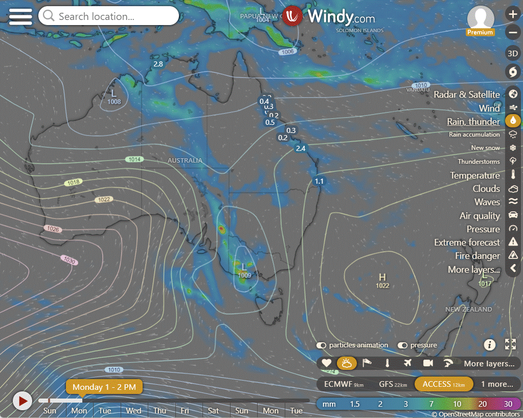
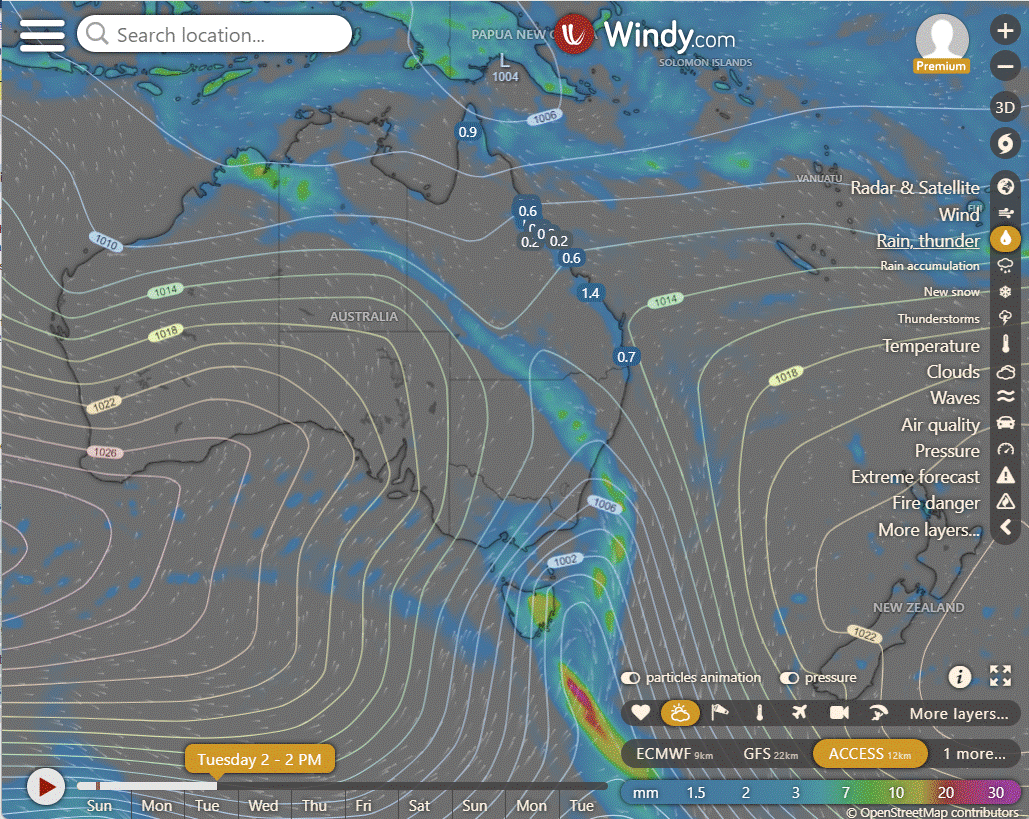
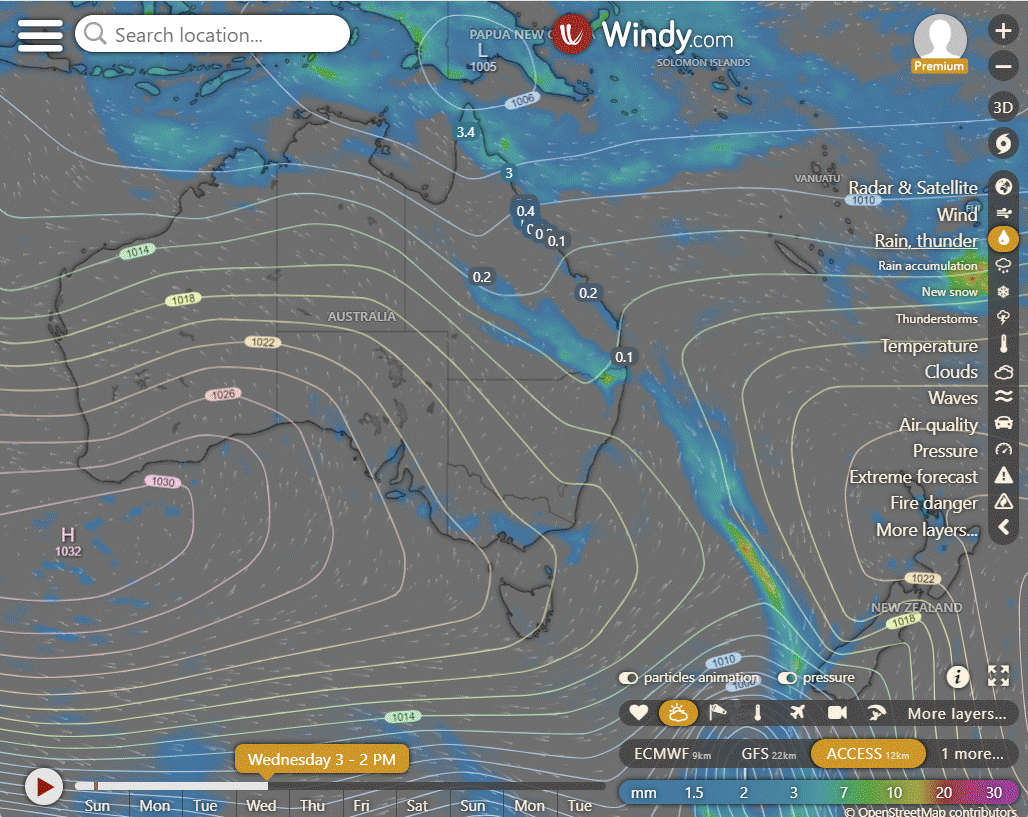
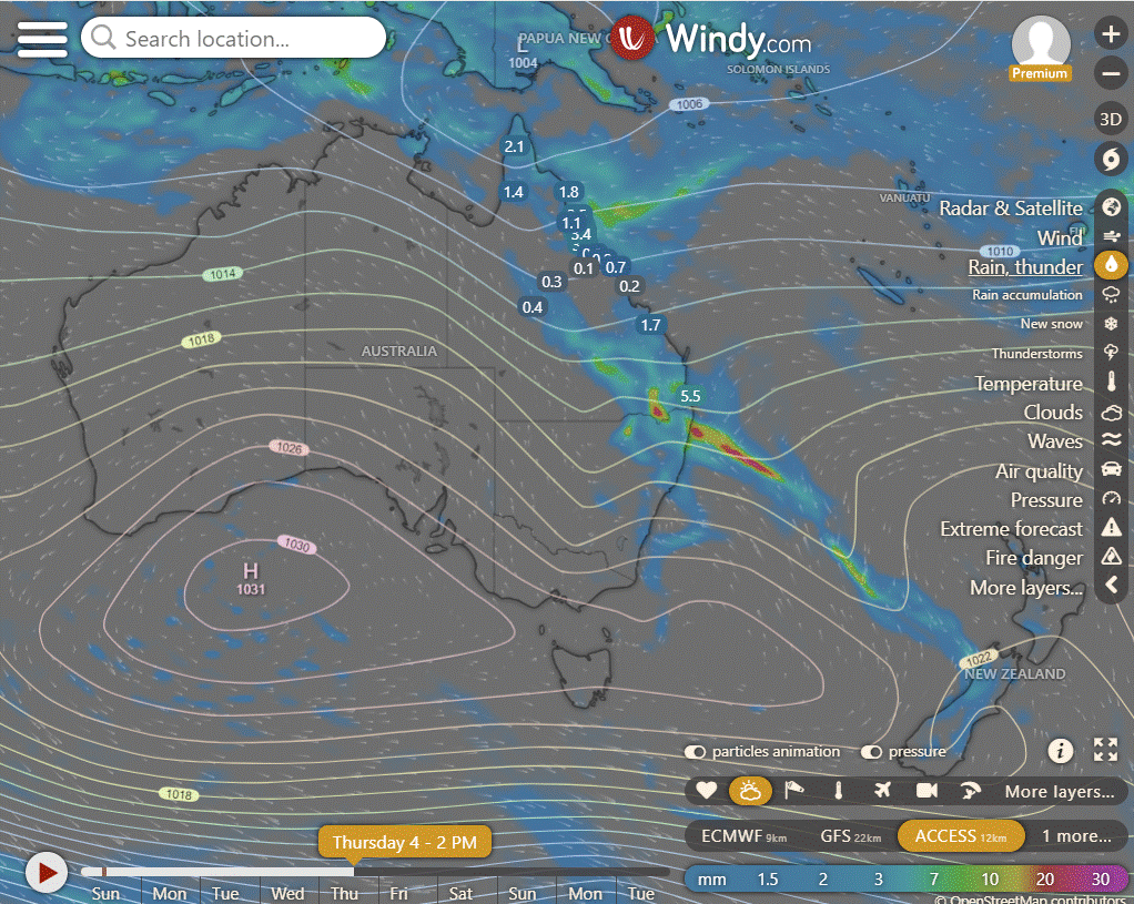
A high in the Tasman Sea will weaken as it drifts east, lingering over the east coast next week. Moisture will be drawn into southwest Queensland by a trough lingering over central Australia. The trough will deepen and move east across southern and central Queensland before reaching the southeast and moving offshore next weekend. A high in the Great Australian Bight will maintain a ridge over western Queensland after the trough.
ACCESS (Values are rainfall over 3 hours)
4-day forecast
The 4 day forecast brought to you by our local businesses, you could have this spot with your details, support local, take out a Bold Shout! $250 for a year, you get this and the website every day! |
Monday: Eastern districts: Isolated showers with possible thunderstorm in North Cape York. Far west, south interior, Central Highlands & Coalfields: Isolated showers. Partly cloudy elsewhere. Max temps near average.
Tuesday: Partly cloudy with isolated showers in most areas. Chance of a thunderstorm in the south and northern Cape York. Morning fog possible in southeast. Temps near average.
Wednesday: Mainly sunny in far southwest, isolated showers elsewhere. Showers likely at times with thunderstorms possible in central and southern districts east of Longreach. Chance of thunderstorm over northwestern Cape York Peninsula. Cooler in far southwest, near average elsewhere.
Thursday: Mostly sunny southwest. Showers elsewhere turning widespread at times with chance of thunderstorm, especially in central and southern districts. Lower maximum temperatures in western Queensland and south of Longreach, near average elsewhere.
North Tropical Coast and Tablelands:
Below average maximum temperatures, showers tending widespread with chance of thunderstorm in central and southern districts east of Longreach, isolated showers elsewhere, chance of thunderstorm over northern Cape York Peninsula, easing conditions by Saturday.
Herbert and Lower Burdekin:
Mostly sunny with isolated to scattered showers, showers tending widespread with a chance of a thunderstorm in central and southern districts, easing on Saturday; below average max temperatures in western Queensland and south of Longreach.
Central Coast and Whitsundays:
Below average maximum temperatures with widespread showers and chance of thunderstorms in central and southern districts east of Longreach on Thursday and Friday, easing on Saturday, isolated to scattered showers elsewhere, mostly sunny in the southwest, and a chance of a thunderstorm over northern Cape York Peninsula.
Peninsula:
Maximum temperatures below average in western Queensland and south of Longreach, near average elsewhere with isolated to scattered showers, showers tending widespread at times, a chance of thunderstorms in central and southern districts east of Longreach on Thursday and Friday, easing Saturday, and a chance of thunderstorms over northern Cape York Peninsula.
Gulf Country:
Below average max temps in western QLD & south of Longreach, near average elsewhere; mostly sunny in southwest, isolated showers elsewhere with rain tending widespread at times and a chance of thunderstorms in central/southern districts east of Longreach on Thurs/Fri, easing Sat, plus chance of thunderstorm over northern Cape York Peninsula.
Northern Goldfields and Upper Flinders:
Mostly sunny with isolated to scattered showers, becoming widespread at times with possible thunderstorms in central and southern districts east of Longreach on Thursday and Friday, easing on Saturday; chance of thunderstorm over northern Cape York Peninsula; below average temperatures in western Queensland and south of Longreach, near average elsewhere.
Capricornia:
Max temperature below average, isolated to scattered showers with showers tending widespread at times and chance of thunderstorm in central and southern districts east of Longreach, easing by Saturday, chance of thunderstorm over northern Cape York Peninsula, wind speed, wind direction, rainfall varies.
Central Highlands and Coalfields:
Max temperature below average in western Queensland and south of Longreach, near average elsewhere, mostly sunny in the southwest, isolated to scattered showers elsewhere, showers tending widespread at times with the chance of a thunderstorm in central and southern districts east of Longreach on Thursday and Friday, easing on Saturday, with a chance of a thunderstorm over northern Cape York Peninsula.
Central West:
Thursday and Friday: Mostly sunny in the southwest with below-average maximum temperatures, isolated to scattered showers elsewhere with showers tending widespread at times and chance of thunderstorms in central and southern districts east of Longreach, easing on Saturday; chance of thunderstorm over northern Cape York Peninsula, wind speed and direction variable, minimal rainfall.
North West:
Below average maximum temperatures in western Queensland and south of Longreach with isolated to scattered showers, possibly turning widespread with thunderstorms in central and southern districts, and a chance of a thunderstorm over northern Cape York Peninsula, easing by Saturday.
Channel Country:
Max temperature: Below average in western Queensland and south of Longreach, near average elsewhere; Min temperature: Not specified; Wind speed: Not specified; Wind direction: Not specified; Rainfall: Showers tending widespread at times with the chance of a thunderstorm in central and southern districts east of Longreach on Thursday and Friday, easing on Saturday; Other: Mostly sunny in the southwest, isolated to scattered showers elsewhere, chance of a thunderstorm over northern Cape York Peninsula.
Maranoa and Warrego:
Maximum temperatures below average in western Queensland and south of Longreach, near average elsewhere with mostly sunny conditions in the southwest, isolated to scattered showers elsewhere and the chance of thunderstorms in central and southern districts east of Longreach, as well as over northern Cape York Peninsula. Wind speed, wind direction, rainfall values are not provided in the text.
Darling Downs and Granite Belt:
The weather forecast includes mostly sunny conditions in the southwest with isolated to scattered showers elsewhere, showers becoming widespread at times with a chance of a thunderstorm in central and southern districts east of Longreach on Thursday and Friday, easing on Saturday, a chance of a thunderstorm over northern Cape York Peninsula, maximum temperatures below average in western Queensland and south of Longreach, near average elsewhere, with details of specific weather elements not provided.
Wide Bay and Burnett:
Mostly sunny with isolated to scattered showers, showers becoming widespread with chance of thunderstorms in central and southern districts, temperatures below average in western Queensland and south of Longreach.
Southeast Coast:
Max temperatures below average in western Queensland and south of Longreach, near average elsewhere, with mostly sunny skies in the southwest and isolated to scattered showers elsewhere, showers becoming widespread at times with the chance of a thunderstorm in central and southern districts east of Longreach on Thursday and Friday easing on Saturday, also a chance of thunderstorm over northern Cape York Peninsula.
WEATHER WARNINGS
Strong winds expected on Monday for Batemans and Eden coasts in NSW/ACT.
Strong wind warning issued for Perth Local Waters, Ningaloo, Gascoyne, Geraldton, Lancelin, Perth, Bunbury Geographe, and Leeuwin coasts in WA.
Strong wind warning for Cooktown and Cairns coasts in QLD, with cancellation for Peninsula Coast.
Monday set for strong wind warning in Investigator Strait & Central and South Central coasts in SA.
Final Gale Warning for Southern Area issued in NSW/ACT.
Strong wind warning for East Gippsland Coast on Monday in VIC.
Initial minor flood warning issued for the Upper Dawson River in QLD.
Flood watch for South West Queensland and Cape York Peninsula in QLD.
Final flood warning for the Mulgrave and Russell Rivers in QLD.
Minor flood warning for the Herbert River in QLD.
Final flood watch for Central And Eastern Interior Parts Of The NT in NT.
Minor flood warning for the Tully River in QLD.
Final flood warning for the Mary River in QLD.
Moderate flood warning for Eyre Creek in QLD.
Moderate flood warning for the Nicholson River and flood warning for the Leichhardt River in QLD.
Flood warning for the Flinders And Cloncurry Rivers in QLD.
Minor flood warning for the Paroo River (Nsw) in NSW/ACT.
Final flood warning for the Barcoo River in QLD.
Final flood warning for the Cape River in QLD.
Flood warning for the Diamantina River in QLD.
Flood warning issued for the Inland Rivers in SA.
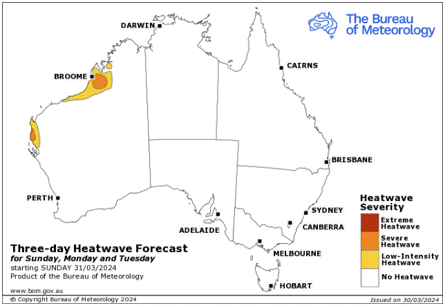
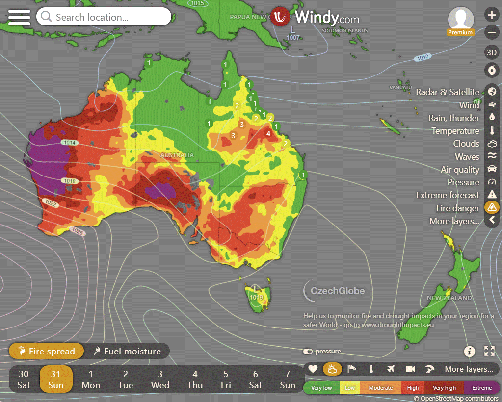
Storms - Heatwave - Fire danger
Click here to support to Wally's Weather
National maps by Weatherzone (weatherzone.com.au)
State maps by Windy (Windy.com)
Weather forecast supplemented by Bureau of Meteorology (bom.gov.au)
Rainfall daily totals (https://meteologix.com/ )
AccuWeather (https://www.accuweather.com/)
Nine Weather (https://www.9news.com.au/weather)
Wally's Weather provides professionally researched data and information. Andrew aka 'Wally' has over 20 years of experience in meteorology research and data analysis. In 2023 finished top 4 for the AMOS national weather forecasting competition. The content here is provided as educational information aimed at providing the community and businesses with the tools required to determine local-based forecasts. IMPORTANT: The forecasts and information posted should never be used on their own to make business decisions as local influences.




Comments