To get your daily forecast delivered free goto http://wallysweather.com.au/blog
An added thanks to the sponsorship from NQ Licensed Events and the Country Festival on March 30 & 31 at the Dittman Bullpit
Website: https://www.countryfest.com.au/
Facebook: https://www.facebook.com/contryfestqld
Instagram: https://www.instagram.com/countryfestqld/
Monsoon Update
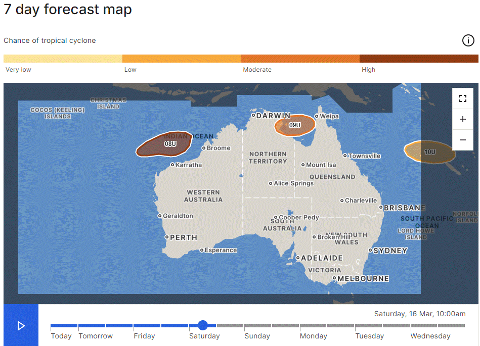
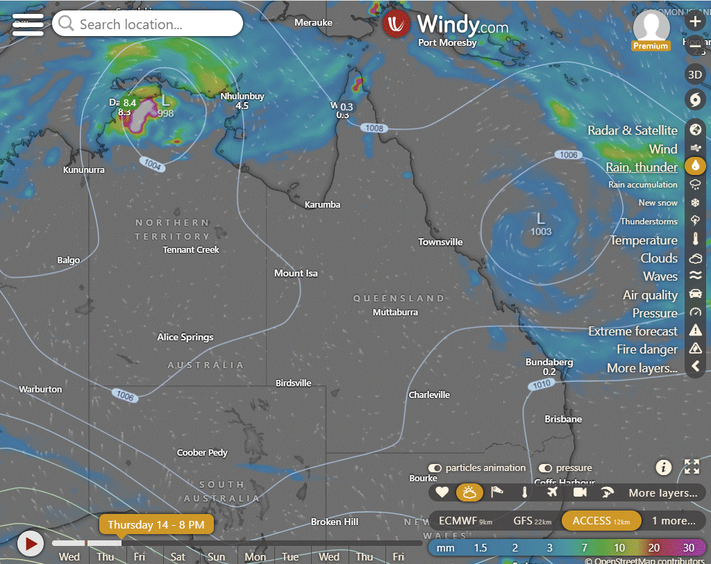
Tropical Low 08U is expected to become a tropical cyclone off the Pilbara coast this weekend, with potential impact on the Pilbara coast if it moves further south. Tropical Low 09U poses a moderate risk of a cyclone for the Gulf of Carpentaria, likely crossing the western Top End coast on Thursday, while Tropical Low 10U carries a low risk of becoming a small cyclone and is expected to stay offshore from the east Queensland coast.
There is evidence the monsoon may not be that intense after the low 09U has completed and shifted South. That could mean the weekend of Pink and Easter is spared from heavy rain.
National
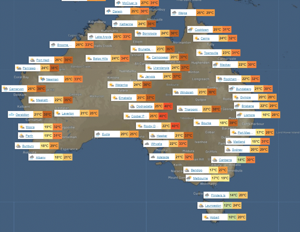
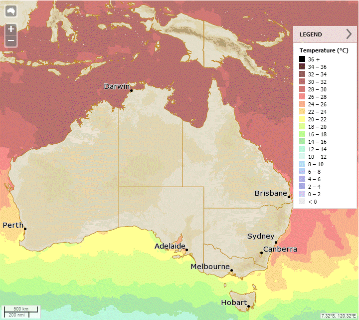
Monsoon lows will bring rain, storms, and gusty winds to the far northern tropics, with renewed instability causing rain and storms in WA's inland and east, patchy light rain in southern SA and VIC, and showers and storms in east QLD under cooler, unstable winds.
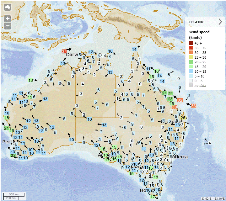
Synoptic | Temp/Rain | Wind | Sea Surface Temp
State
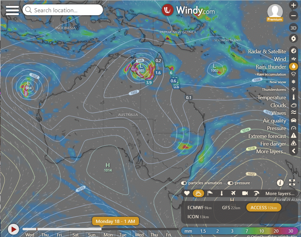
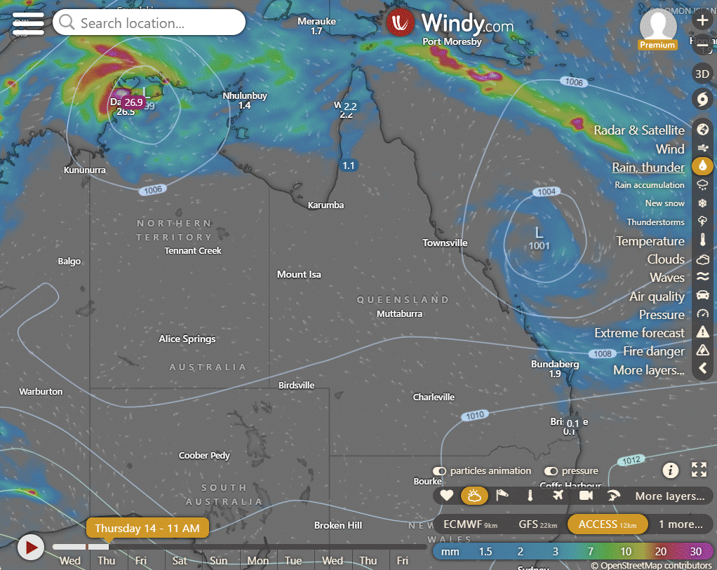
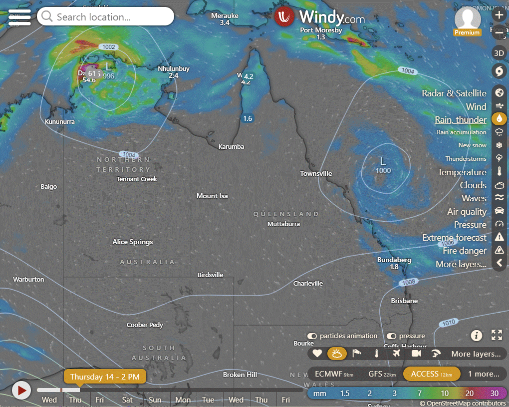
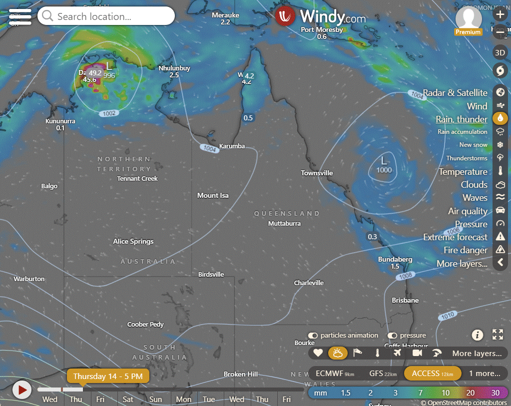
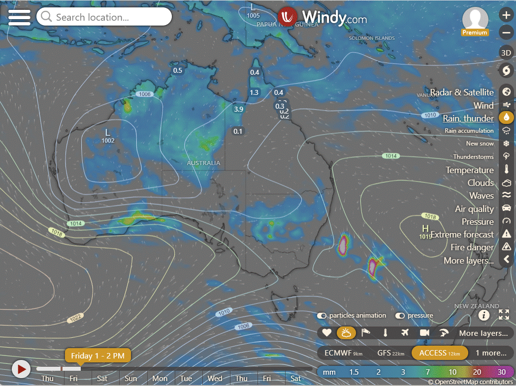
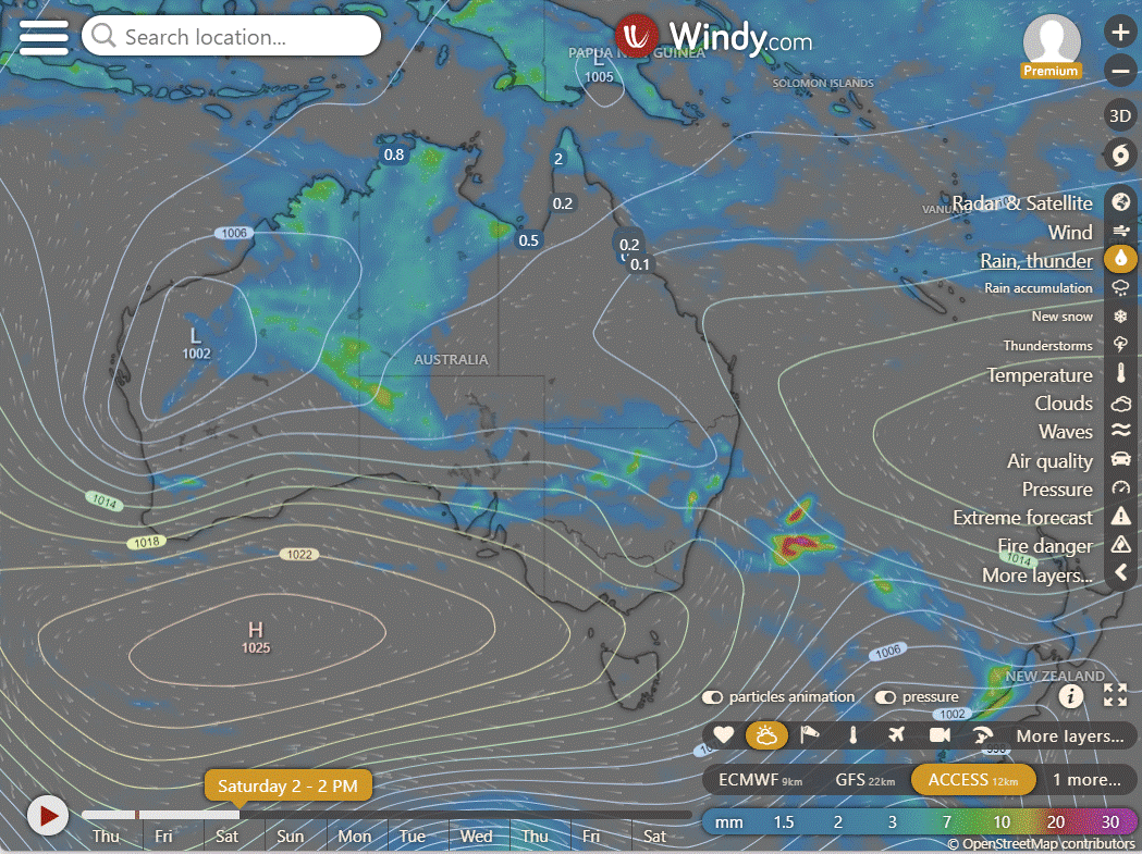
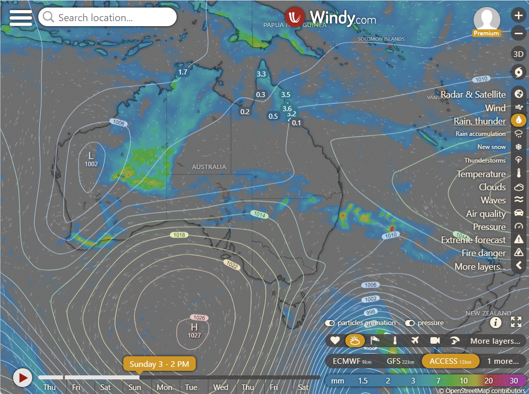
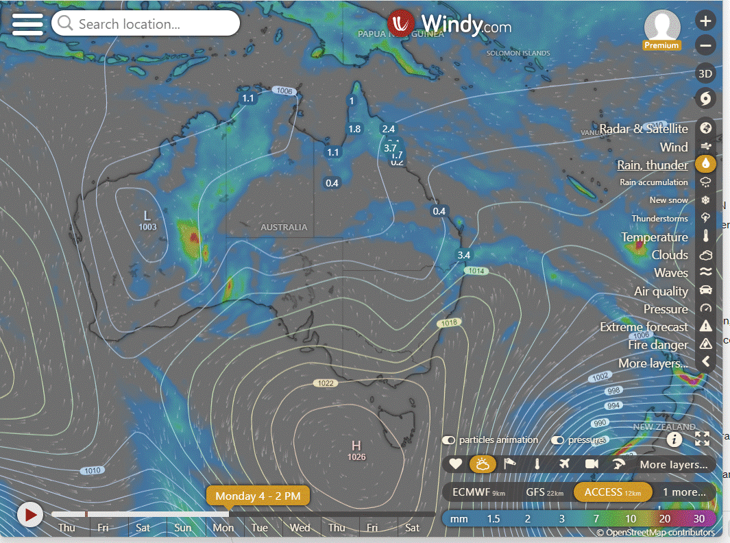
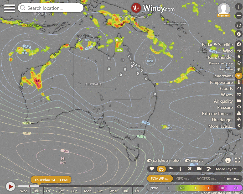
High in Tasman Sea maintains ridge over state. Offshore trough in Coral Sea links to low pressure system off Central Coast. Monsoon trough from Arafura Sea to Torres Strait extending into NW Coral Sea. Trough persists, may shift south over weekend. Weak tropical low moving east over northern Cape to Coral Sea today, possibly deepening. Another tropical low may form in Gulf of Carpentaria over weekend, possibly deepening. New high moving east across Great Australian Bight late week, bringing southeasterly wind surge, increasing showers in southeastern Queensland from Friday, and in central Queensland and Central Coast over weekend, pushing moisture inland.
ACCESS (Values are rainfall over 3 hours)
4-day
Thursday: Variably cloudy with showers and thunderstorms in the north, rain possible in far north areas. Showers in the east, clear elsewhere. Winds mainly light to moderate, stronger in coastal areas.
Friday: Scattered showers and isolated thunderstorms north of Georgetown. Heavy rain possible over northern Cape York Peninsula. Sunny with above-average temperatures for most areas.
Saturday: Central and southwestern areas mostly sunny. Showers possible in other areas, with isolated thunderstorms in north Georgetown and far south interior. Heavy rain possible in Cape York Peninsula and Gulf Country coast. Above average temperatures in western and southern interior, near average elsewhere.
Sunday: Mainly sunny in central and southwestern areas, isolated showers elsewhere with possible thunderstorms in Hughenden and far southern interior. Showers becoming widespread in Cape York Peninsula, Gulf Country coast, and North Tropical Coast. Above-average temperatures in western and southern interior, near average elsewhere.
North Tropical Coast and Tablelands:
The weather forecast includes a maximum temperature of 34°C, a minimum temperature of 17-22°C, wind speeds of 15-20 km/h transitioning to light, winds from the east to southeasterly direction, and partly cloudy skies with no mention of rainfall.
Herbert and Lower Burdekin:
Partly cloudy with light winds, overnight temperatures falling to 19-23°C and daytime temperatures reaching low to mid 30s with no rainfall and moderate wind speed from varying directions.
Central Coast and Whitsundays:
Max temperature: 34°C, Min temperature: low 20s, Wind speed: 15 to 25 km/h becoming light, Wind direction: South to southeasterly, Rainfall: Slight chance of a shower, Other: Partly cloudy with overnight temperatures falling in the low 20s.
Peninsula:
Max temperature: 36°C, Min temperature: 20°C, Wind speed: Light, Wind direction: Variable, Rainfall: Showers likely, Other: Partly cloudy with chance of thunderstorms.
Gulf Country:
Max temperature: mid to high 30s, Min temperature: low to mid 20s, Wind speed: light, Wind direction: N/A, Rainfall: slight chance of a shower near east coast, Mostly sunny with chance of thunderstorm near east coast in the afternoon and evening.
Northern Goldfields and Upper Flinders:
Mostly sunny with light winds, overnight temperatures dropping to 19-22°C, daytime temperatures reaching low to high 30s, with no rainfall expected, and moderate wind speeds with variable direction.
Capricornia:
Max temperature: 30°C, Min temperature: 19-23°C, Wind speed: 15-25 km/h southeasterly, Wind direction: southeasterly, Rainfall: Slight chance of a shower in late morning/afternoon, Other: Cloudy.
Central Highlands and Coalfields:
Daytime temperatures will reach low to mid 30s with overnight temperatures between 17 and 22, partly cloudy skies, light winds becoming southeasterly at 15 to 20 km/h in the morning then becoming light in the evening, and no rainfall expected.
Central West:
Max temperature: mid to high 30s, Min temperature: around 20, Wind speed: light in the evening, Wind direction: easterly to southeasterly, Rainfall: Sunny.
North West:
The weather will be hot with a high of around 30 degrees Celsius and a low in the low 20s, with light winds becoming easterly to southeasterly at 15 to 20 km/h in the late afternoon before becoming light in the evening, and sunny conditions with no rainfall expected.
Channel Country:
High of 40°C, low in the low 20s, easterly winds at 15-20 km/h becoming light, and sunny with no rainfall expected.
Maranoa and Warrego:
The weather forecast is for a hot day with temperatures ranging from 34 to 39 degrees Celsius, with light winds shifting from east to southeasterly and overnight temperatures dropping to 17 to 21.
Darling Downs and Granite Belt:
Maximum temperature: 36, Minimum temperature: 15, Wind speed: Light, Wind direction: Northeast to southeasterly, Rainfall: N/A, Weather: Sunny
Wide Bay and Burnett:
The weather forecast includes a maximum temperature of around 30, minimum temperature between 17-22, southeasterly winds 15-25 km/h becoming light, and a possibility of showers along the coast and partly cloudy conditions elsewhere.
Southeast Coast:
The weather will be partly cloudy with a slight chance of a shower in the north, light winds becoming east to southeasterly, temperatures falling to 17-21 overnight and reaching around 30 during the day.
WEATHER WARNINGS
Strong Wind Warning issued for Thursday along Sydney, Illawarra, Batemans, and Eden coasts.
Gale Warning for Great Barrier Reef Offshore Waters, Mackay Coast, and Strong Wind Warning for Torres Strait, Townsville, Capricornia, and K'gari coasts in Queensland.
Severe Weather Warning for heavy rainfall in parts of Goldfields, Eucla, and South Interior districts in Western Australia.
Tropical Cyclone Technical Bulletin and Ocean Wind Warning issued for a tropical cyclone off the WA coast.
Strong Wind Warning for Beagle Bonaparte, North Tiwi, and Arafura coasts, along with Severe Weather Warnings for damaging winds, heavy rainfall, and damaging surf in parts of Northern Territory.
Flood Warnings for the Oakover, Nullagine, and Fitzroy Rivers in WA, and Flood Watch for various rivers and districts in WA, NT, and Queensland.
Minor Flood Warning for the Paroo River in Queensland.
Final Flood Warning for the Waterhouse River in NT.
Moderate Flood Warning for Eyre Creek and Minor Flood Warning for the Georgina River in Queensland.
Flood Warnings for the Eucla and Salt Lakes District Rivers in WA, and Victoria River in NT.
Minor Flood Warning for the Katherine River in NT.
Flood Warning for the Inland Rivers in South Australia.
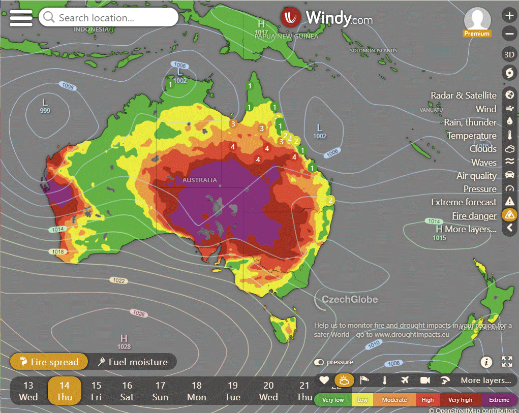
Storms - Heatwave - Fire danger
Click here to support to Wally's Weather
National maps by Weatherzone (weatherzone.com.au)
State maps by Windy (Windy.com)
Weather forecast supplemented by Bureau of Meteorology (bom.gov.au)
Rainfall daily totals (https://meteologix.com/ )
AccuWeather (https://www.accuweather.com/)
Nine Weather (https://www.9news.com.au/weather)
Wally's Weather provides professionally researched data and information. Andrew aka 'Wally' has over 20 years of experience in meteorology research and data analysis. In 2023 finished top 4 for the AMOS national weather forecasting competition. The content here is provided as educational information aimed at providing the community and businesses with the tools required to determine local-based forecasts. IMPORTANT: The forecasts and information posted should never be used on their own to make business decisions as local influences.




Comments