To get your daily forecast delivered free goto http://wallysweather.com.au/blog
This weather update is brought to you by Genesis Electrical NQ

Genesis Electrical NQ
We can Solve all of your Electrical, Air Conditioning and Solar needs!
Phone: 1300 443 637
Email: info@genesislec.com
Monsoon Update
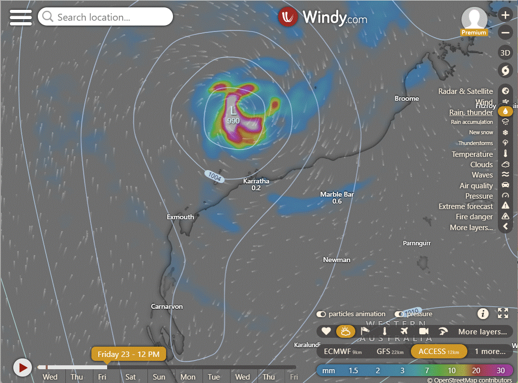
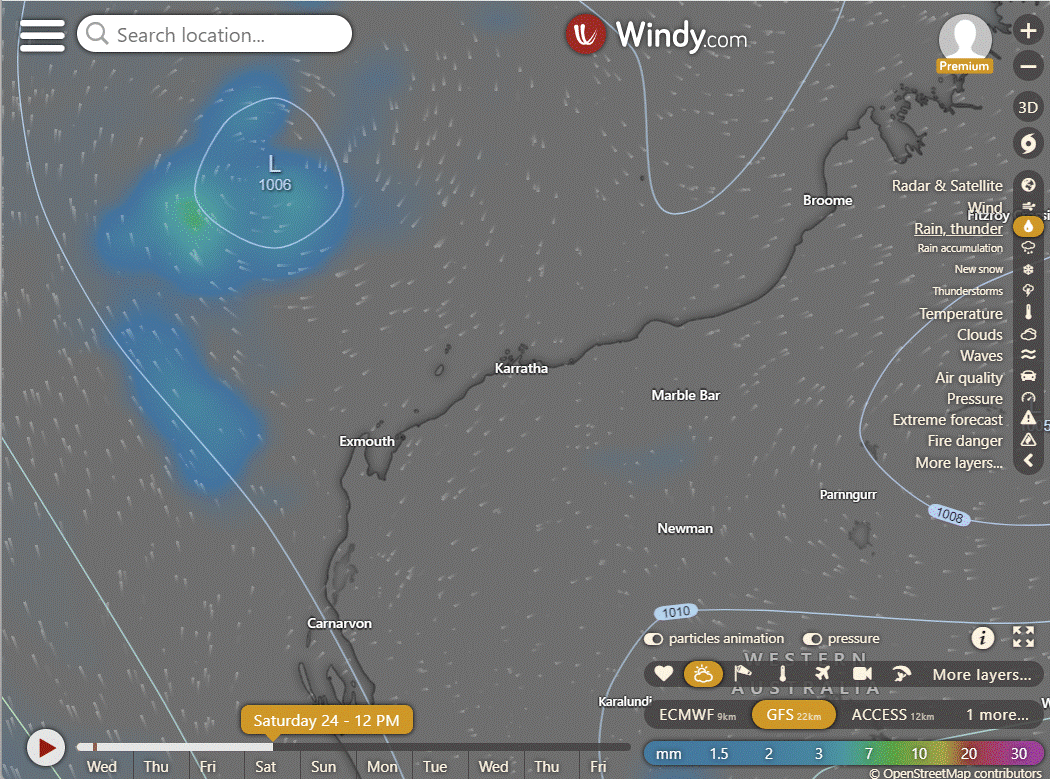
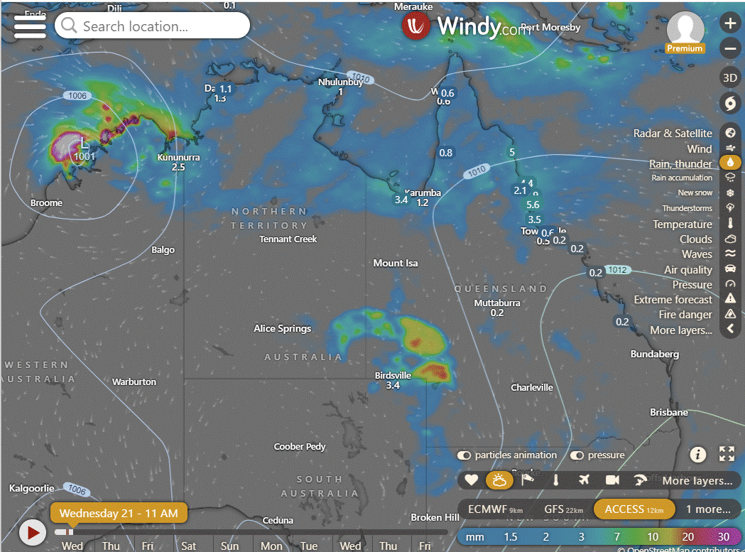
Ex TC Lincoln is currently about 411 kilometers east of Broome, Australia, it will keep moving in a west-northwest direction, possibly strengthening as it moves over the ocean. The estimated maximum sustained surface winds are around 20 to 25 knots, and the minimum sea level pressure is approximately 1000 hPa. If conditions continue, there is a medium chance that this weather system could develop into a significant tropical cyclone within the next 24 hours. There is little agreement beyond 48 hours of position and intensity.
National
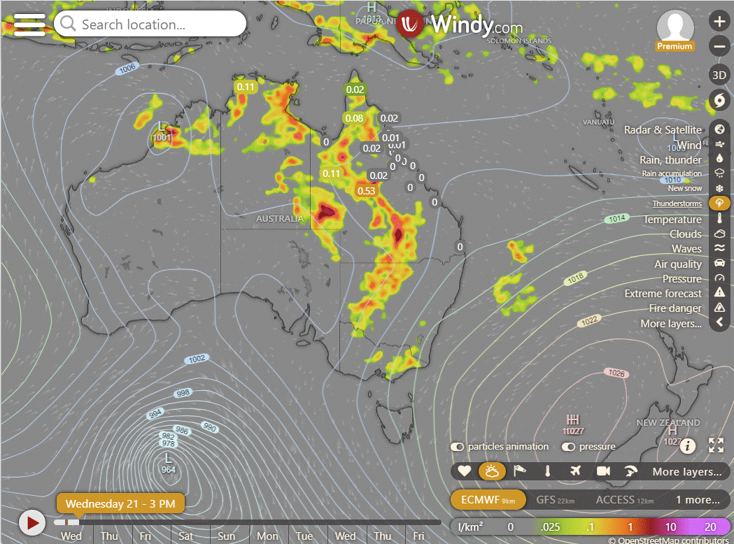
Storms and showers along the eastern seaboard, eastern interior, and across the tropics due to increasing humid east/northeast winds. Isolated showers and storms expected in eastern VIC and TAS. High-pressure system keeping the rest of the areas dry while maintaining hot winds in SA. A front will bring cooler temperatures to southern WA.
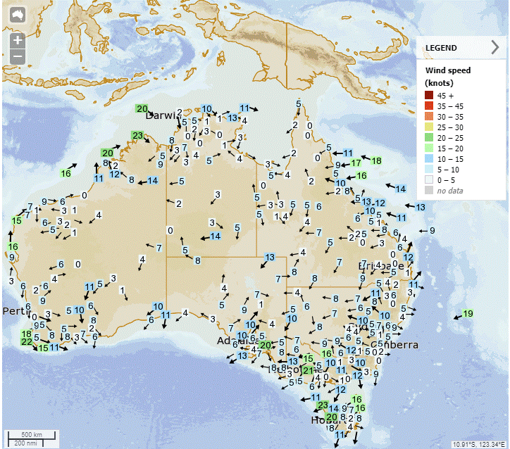
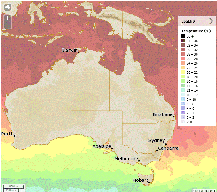
Synoptic | Temp/Rain | Wind | Sea Surface Temp
State
Eastern Queensland ridge persists due to Tasman Sea high pressure. Slow moving trough brings showers and storms in Far North Queensland. Trough shifts east across Queensland. Upper trough enhances storms in southwest and northeastern tropics.
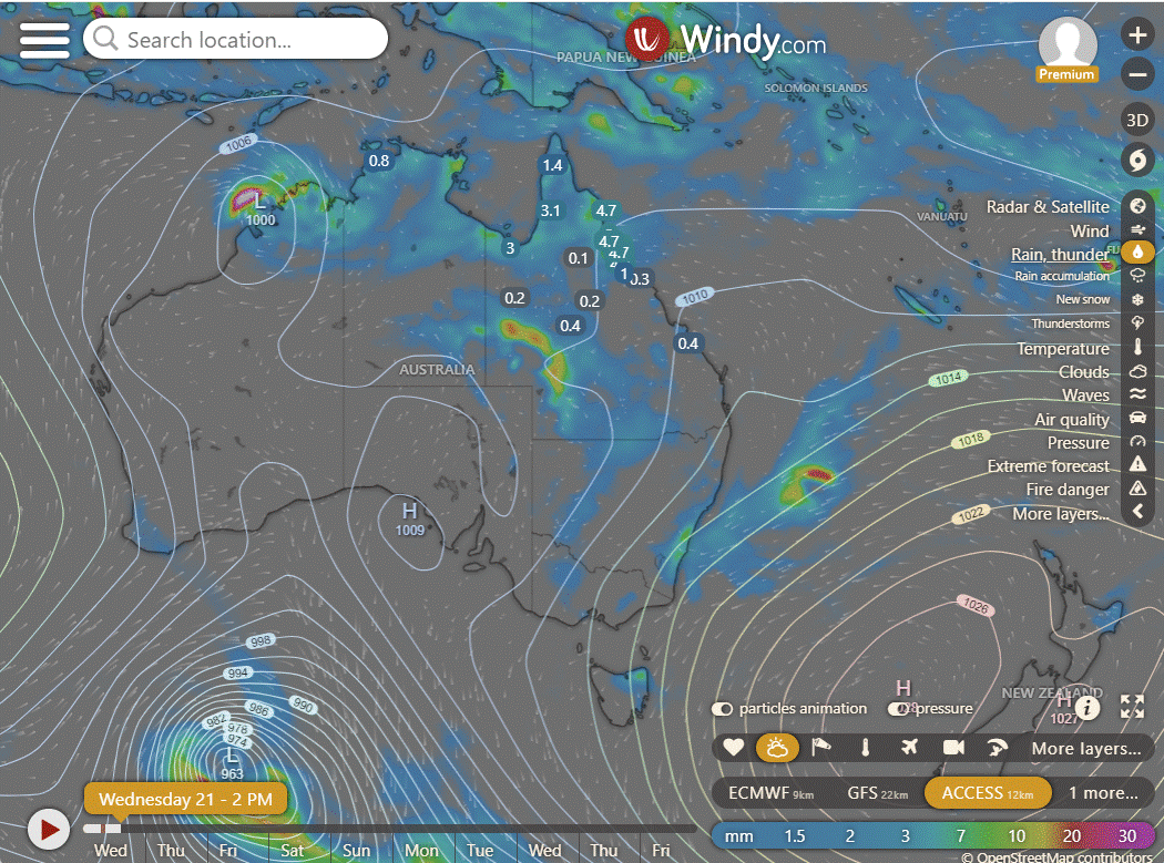
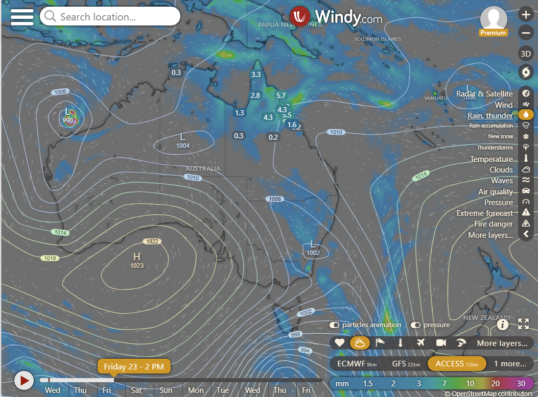
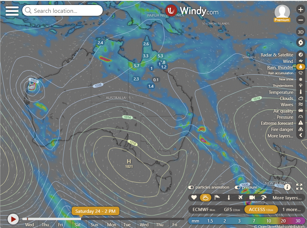
ACCESS (Values are rainfall over 3 hours)
4-day
Thursday: - Showers and storms in northern Queensland, increasing at times in Gulf, Peninsula, and northeast coast. Also showers and storms in central and southern interior, with varied temperatures.
Friday: Varied showers and thunderstorms expected across Queensland, with possible severe storms in the southeast near the New South Wales border. Temperatures below average in the northwest, above average in the south and central, and average elsewhere.
Saturday: Showers and storms in northern Queensland, varying across eastern, central, southern districts with some sunshine in the far southwest. Showers may become more widespread in central to southeastern areas with potential for severe thunderstorms. Temperature highs near average in the north and west, and above average in central and southeastern regions.
Sunday: Mixed weather with showers and storms in northern and eastern Queensland, turning isolated in other regions. Showers moving to northern Queensland, becoming isolated in remaining areas. Mostly sunny in the southwest and central regions. Warmer temperatures in central and southern Queensland, slightly cooler in the northwest.
North Tropical Coast and Tablelands:
Maximum temperatures above average in central and southern Queensland, slightly below average in the northwest with isolated to scattered showers and thunderstorms in northern and eastern Queensland, partly cloudy in the southwest, scattered showers and isolated thunderstorms contracting to northern Queensland, and mostly sunny in the southwest and remaining interior.
Herbert and Lower Burdekin:
Max temperature above average in central and southern Queensland, slightly below average in the northwest, isolated to scattered showers and thunderstorms mainly in northern and eastern Queensland, partly cloudy in the southwest, scattered showers contracting to northern Queensland on Monday, mostly sunny in the southwest and remaining interior.
Central Coast and Whitsundays:
Maximum temperatures above average, wind speed increasing with occasional showers and isolated thunderstorms in northern and eastern Queensland, partly cloudy conditions prevailing in the southwest, while the southwest and remaining interior are mostly sunny with below average temperatures in the northwest.
Peninsula:
Max temperatures above average in central and southern Queensland, slightly below average in the northwest; isolated to scattered showers and thunderstorms in northern and eastern Queensland, tending isolated in the North West, Central West, and southern interior; partly cloudy in the southwest; scattered showers and isolated thunderstorms contracting to northern Queensland from Monday; showers tending isolated over remaining eastern and central districts; mostly sunny over the southwest and remaining interior with minimum temperatures and winds not specified.
Gulf Country:
Max temperatures above average in central and southern Queensland, slightly below average in the northwest, with isolated to scattered showers and thunderstorms in northern and eastern Queensland, partly cloudy in the southwest, and showers tending isolated in remaining eastern and central districts while mostly sunny in the southwest and remaining interior regions; wind speeds and directions variable, rainfall expected in some areas.
Northern Goldfields and Upper Flinders:
Maximum temperatures above average, scattered showers and isolated thunderstorms, partly cloudy in the southwest, winds with varying intensity and direction, rainfall mainly concentrated in northern and eastern Queensland.
Capricornia:
Maximum temperatures above average in central and southern Queensland, slightly below average in the northwest, with isolated to scattered showers and thunderstorms in the north and east, partly cloudy in the southwest, and mostly sunny in the southwest and interior; wind speeds, directions, rainfall varying accordingly.
Central Highlands and Coalfields:
Max temperatures: Above average in central and southern Queensland, slightly below average in the northwest; Min temperatures: Not available; Wind speed: Variable; Wind direction: Variable; Rainfall: Isolated to scattered showers and thunderstorms with contraction to northern Queensland from Monday; Other: Partly cloudy in the southwest, mostly sunny in the southwest and remaining interior.
Central West:
Maximum temperatures above average, minimum temperatures slightly below average, moderate winds from various directions, isolated rainfall with scattered showers and thunderstorms mainly in northern and eastern Queensland, and partly cloudy conditions with mostly sunny skies in the southwest, while showers contract to the north starting Monday.
North West:
Maximum temperatures above average in central and southern Queensland, slightly below average in the northwest, with isolated to scattered showers and thunderstorms in northern and eastern Queensland, showers and thunderstorms contracting to northern Queensland from Monday, and mostly sunny conditions in the southwest and remaining interior.
Channel Country:
The weather forecast includes above-average maximum temperatures in central and southern Queensland, slightly below average in the northwest, isolated to scattered showers and thunderstorms in northern and eastern Queensland, tending isolated about the North West, Central West and southern interior, partly cloudy in the southwest, and mostly sunny over the southwest and remaining interior, with wind speed and direction not explicitly mentioned.
Maranoa and Warrego:
Max temperature: Above average in central and southern Queensland, slightly below average in the northwest; Min temperature: Not provided; Wind speed: Not provided; Wind direction: Not provided; Rainfall: Isolated to scattered showers and thunderstorms in northern and eastern Queensland, with showers tending isolated over remaining eastern and central districts; Other: Partly cloudy in the southwest, scattered showers and isolated thunderstorms contracting to northern Queensland, and mostly sunny over the southwest and remaining interior.
Darling Downs and Granite Belt:
Maximum temperatures will be above average in central and southern Queensland, slightly below average in the northwest with isolated to scattered showers and thunderstorms in northern and eastern Queensland, and partly cloudy conditions in the southwest, with wind speed, direction, and rainfall varying throughout the region.
Wide Bay and Burnett:
Above-average maximum temperatures with scattered showers and isolated thunderstorms mainly in northern and eastern Queensland, winds varying in speed and direction, with isolated showers and partly cloudy conditions prevailing elsewhere.
Southeast Coast:
Max temperatures above average, wind speed, direction, isolated to scattered showers and thunderstorms mainly in northern/eastern Queensland, some in North/Central West, southern interior, partly cloudy in southwest, contracting to northern Queensland, sunny in southwest/interior with below-average temperatures in northwest.
WEATHER WARNINGS
Strong Wind Warning for North Kimberley, West Kimberley, Ningaloo, Gascoyne, Leeuwin, Albany, Esperance, and Eucla coasts.
Fire Weather Warning for Lakes, Fitzgerald Coast, Fitzgerald Inland, Esperance Coast, and Esperance Inland.
Severe Thunderstorm Warning (Heavy Rainfall) for parts of North East and East Coast.
Strong Wind Warning for Thursday for Spencer Gulf, Port Phillip & Central Coast, Storm Bay & Lower East, and South East coasts.
Severe Weather Warning (Heavy Rainfall) for parts of Kimberley district.
Final Flood Warning For The Dawson And Isaac Rivers.
Flood Watch For East, West, And North Kimberley And Fitzroy Rivers And Sturt Creek District.
Major Flood Warning For The Flinders River.
Minor Flood Warning For The Bulloo River.
Flood Watch For Parts Of Central Inland Rivers, Bonaparte Coastal Rivers, And Kimberley.
Major Flood Warning For The Nicholson River.
Minor Flood Warning For The Daly River.
Moderate Flood Warning For The Diamantina River.
Initial Minor Flood Warning For The Warrego River (NSW).
Minor Flood Warning For The Paroo River (Qld).
Minor Flood Warning For The Bokhara River.
Minor Flood Warning For The Barcoo River And Cooper Creek.
Flood Warning For The Inland Rivers Sa.
Minor Flood Warning For The Paroo River (NSW).
Moderate Flood Warning For Eyre Creek And Minor Flood Warning For The Georgina River.
Final Flood Warning For The Lower Warrego River (Qld).
Final Flood Warning For The Moonie River.
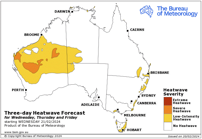
Storms - Heatwave - Fire danger
Click here to support to Wally's Weather
National maps by Weatherzone (weatherzone.com.au)
State maps by Windy (Windy.com)
Weather forecast supplemented by Bureau of Meteorology (bom.gov.au)
Rainfall daily totals (https://meteologix.com/ )
AccuWeather (https://www.accuweather.com/)
Nine Weather (https://www.9news.com.au/weather)
Wally's Weather provides professionally researched data and information. Andrew aka 'Wally' has over 20 years of experience in meteorology research and data analysis. In 2023 finished top 4 for the AMOS national weather forecasting competition. The content here is provided as educational information aimed at providing the community and businesses with the tools required to determine local-based forecasts. IMPORTANT: The forecasts and information posted should never be used on their own to make business decisions as local influences.









Comments