
This weather update is brought to you by Genesis Electrical NQ

Genesis Electrical NQ
We can Solve all of your Electrical, Air Conditioning and Solar needs!
Green Energy Initiative
Phone: 1300 443 637
Email: info@genesislec.com
Special report
Monsoon:
We are monitoring a low pressure system in the Solomon Sea identified as INVEST 92P east of Honiara, Guadalcanal. Satellite imagery and microwave data show a broad but weak low-level circulation with scattered intense convection on the northern side. Environmental analysis suggests that conditions are favourable for development, with good upper-level outflow, low vertical wind shear (5-10 knots), and warm sea surface temperatures (29-30°C). Global models predict that the system will move westward toward the Solomon Islands, intensify over the next 48 hours, and then shift poleward around Tau 96. The estimated maximum sustained winds are 20 to 25 knots, and the minimum sea level pressure is around 1006 mb. There is a medium likelihood of it becoming a significant tropical cyclone in the next 24 hours.
Storms:
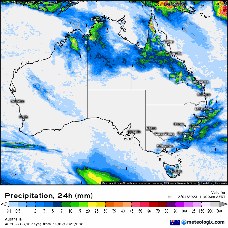
Troughs maintaining heat, causing showers & storms in northern tropics, NT, QLD, northern WA, southeast NSW & eastern VIC. Dry heat persists across WA's interior & east. Gusty southerly change moving along the NSW coast. High pressure keeping elsewhere dry.
Weather warnings:
Strong wind warning for Esperance and Eucla coasts, and flood warnings for Snowy River, Buchan River, Macalister River, Bunyip River, Genoa River, Cann River, Latrobe River, Mitchell River, Thomson River, Tambo River, Avon River, St Georges Basin, Lower Weir River, Barcoo River, Moonie River, and Wallam Creek.
Fire Weather Warning for Mortlock, Avon, Lockwood, Roe, Lakes, Stirling North, Fitzgerald Coast, and Fitzgerald Inland.
Minor Flood Warnings for the Paroo River (Qld) and (Nsw).
Cancellation of Sheep Graziers Warning for Snowy Mountains & South Coast.
Storm probabilities 2PM | Rain Accumulation 3 days | Rain 8 x 24 hour accumulated | JTWC Monsoon System Tracking


National
Weak pressure gradient and warm, unstable air over northern Queensland. Broad trough over western, central, and southern areas. Southern portion crosses southeast Queensland Monday, inland portion weakens. High moves into Tasman Sea, extends ridge northward over state. Ridge persists over east for most of next week. New trough possible in south next weekend.


State
Weak pressure gradient and warm, unstable air over northern Queensland. Broad trough over western, central, and southern Queensland. Southern part of trough crosses southeast on Monday, while inland part weakens. High moves into Tasman Sea, extends ridge over most of state. Ridge persists over east for most of next week. New trough may move across southern Queensland next weekend.


4-day
Sunday: Isolated to scattered showers and thunderstorms in the east and north, becoming widespread over inland parts of North Tropical Coast. Possible severe thunderstorms in the northwest and central/southeast Queensland. Mostly clear in the southwest and southern interior. Light to moderate winds from the northwest to northeast in the east and north, light to moderate winds from the southeast to southwest elsewhere.
Monday: Some rain and thunderstorms in the east and north, with scattered showers possible in the west, southern Gulf Coast, and east coast south of Rockhampton. Southwest and southern interior mostly sunny. Very hot in the north and northeast. Temperatures near average in the southeast, above average elsewhere.
Tuesday: Eastern districts: Isolated showers, scattered on east coast and Far North Queensland. Thunderstorms in central and northern Queensland, mostly inland. Mostly sunny elsewhere. Severe heatwave in southwest, Gulf Country, and western Peninsula. Average temps in east, above average elsewhere.
Wednesday: Isolated showers on east coast, scattered on North Tropical Coast and eastern Peninsula. Isolated showers and chance of thunderstorm in northwest and western Peninsula. Mostly sunny elsewhere. Severe heatwave in southwest, Gulf Country, and western Peninsula. Temps near average in east, above average elsewhere, well above average in southwest.


North Tropical Coast and Tablelands (Cairns):
Maximum temperature: 30-36, Minimum temperature: low to mid 20s, Wind: light winds becoming east to northeasterly 15 to 20 km/h, Rainfall: near zero chance of rain, Other: partly cloudy, medium chance of showers in the south, most likely in the afternoon and evening, chance of a thunderstorm.
Herbert and Lower Burdekin (Townsville):
Max temp: low to mid 30s, Min temp: low to mid 20s, Wind: light, Rainfall: possible showers inland, partly cloudy, Thunderstorm likely.
Central Coast and Whitsundays (Mackay):
High chance of showers with the max temperature reaching the low to mid 30s, light winds becoming northeasterly and overnight temperatures falling to the low to mid 20s.
Peninsula:
High chance of showers south of Palmerville, slight chance elsewhere with mostly sunny weather, thunderstorm possible, winds changing direction and speeds between 15 to 20 km/h, overnight temperatures in low to mid 20s and daytime temperatures in mid to high 30s.
Gulf Country:
Max temperature: mid to high 30s, Min temperature: mid-20s, Wind speed: light, Wind direction: unspecified, Rainfall: High chance of showers, mostly late morning and afternoon, with a chance of a thunderstorm; other: Partly cloudy.
Northern Goldfields and Upper Flinders:
Max temperature: 32-38°C, Min temperature: low to mid 20s, Wind: light becoming southeast to southwesterly 15-20 km/h in early afternoon then tending northeast to southeasterly in evening, Rainfall: Partly cloudy, high chance of showers in east, medium chance elsewhere, Other: chance of thunderstorm.
Capricornia:
Max temperature: low to mid 30s | Min temperature: low to mid 20s | Wind speed: light | Wind direction: north to northeasterly | Rainfall: showers in late morning and afternoon | Other: Partly cloudy, chance of thunderstorm in southwest.
Central Highlands and Coalfields:
Max temperature: mid 30s, Min temperature: 19-24, Wind speed: light, Wind direction: N/A, Rainfall: medium chance of showers, Weather conditions: partly cloudy with possible thunderstorm and severe; slight chance of showers, Light winds.
Central West:
Max temperature: 35-41°C, Min temperature: low to mid 20s°C, Wind: E-SE 15-25 km/h becoming light, Rainfall: Mostly sunny, slight chance of a shower in NE, near zero chance elsewhere, Thunderstorm: possible severe in far east.
North West:
Maximum temperature of 40 with light winds becoming southeast to southwesterly, chance of showers in northwest, slight chance elsewhere, chance of thunderstorm, overnight temperatures low to mid 20s.
Channel Country:
Sunny day with max temp of 40, min temp in low to mid 20s, winds SSE 15-20km/h becoming SE then SSE 15-25km/h, chance of thunderstorm near NT border in late afternoon/evening.
Maranoa and Warrego:
Max temperature: mid 30s, Min temperature: around 19, Wind speed: light, Wind direction: south to southwesterly, Rainfall: Sunny day, Chance of thunderstorm in northeast in late afternoon and evening.
Darling Downs and Granite Belt:
Mostly sunny with severe thunderstorm chance in the north, light winds becoming southwesterly 15 to 20 km/h, overnight temperatures between 16 and 19, and daytime temperatures reaching low to mid 30s.
Wide Bay and Burnett:
Max temperature: low to mid 30s, Min temperature: 19-23, Wind speed: light, Wind direction: northwest to southwesterly, Rainfall: Partly cloudy with medium chance of showers in the north and slight chance elsewhere, Chance of severe thunderstorm.
Southeast Coast:
Max temperature: 31 to 36, Min temperature: 18 to 21, Wind speed: Light, Wind direction: Not specified, Rainfall: Slight chance of a shower near the coast, near zero chance elsewhere, Other: Partly cloudy with a chance of a severe thunderstorm in the far north.
Click here to support to Wally's Weather
National maps by Weatherzone (weatherzone.com.au)
State maps by Windy (Windy.com)
Weather forecast supplemented by Bureau of Meteorology (bom.gov.au)
Rainfall daily totals (https://meteologix.com/ )
AccuWeather (https://www.accuweather.com/)
Nine Weather (https://www.9news.com.au/weather)
Wally's Weather provides professionally researched data and information. Andrew aka 'Wally' has over 20 years of experience in meteorology research and data analysis. In 2023 finished top 4 for the AMOS national weather forecasting competition. The content here is provided as educational information aimed at providing the community and businesses with the tools required to determine local-based forecasts. IMPORTANT: The forecasts and information posted should never be used on their own to make business decisions as local influences.
Comments