To get your daily forecast delivered free goto http://wallysweather.com.au/blog

Welcome Garry Thyer's Betta
Hyde Park Centre
Our prime daily forecast sponsors for August to October inclusive.
Address: Shop 8, Hyde Park Centre, Woolcock St, Hyde Park QLD 4812
Phone: (07) 4721 1211
National - Warnings - 4 Day - State - Min-Max-Rain - Regional Round-Up
National
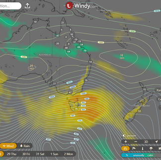
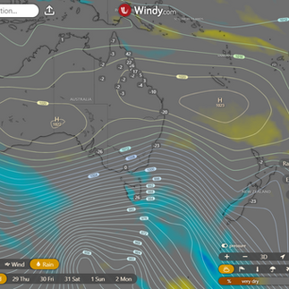
Energetic cold fronts will sweep through SA's southeast, Tas, Vic, and eastern NSW, delivering a mix of strong, gusty winds and showers—some of which will come down as snow over the Alps and Tasmanian highlands. Meanwhile, a front will make its way to southwest WA, dribbling in some late showers. Up north, high pressure ensures it remains hot and largely dry, because apparently, it’s too busy to bother with rain.
Synoptic | Temp/Rain | Wind | Sea Surface Temp
National Warnings
WA: Gale Warning for Esperance Coast; Strong Wind Warning for Albany and Eucla coasts; cancellation for Perth Local, Bunbury Geographe, and Leeuwin coasts
SA: Severe Weather Warning for Mt Lofty Ranges, Kangaroo Island, Upper South East, Lower South East, Murraylands, and Adelaide districts (damaging winds)
TAS: Initial Flood Warning for the Styx River
VIC: Severe Weather Warning for Central, E Gippsland, South West, W & S Gippsland, N Central, NE, and Wimmera (damaging, locally destructive winds)
TAS: Severe Weather Warning for King Island, Furneaux Islands, Western, Upper Derwent, SE, NE, East Coast, NW Coast, Central North, Central Plateau, and Midlands (destructive winds)
VIC: Sheep Graziers Warning for South West and West and South Gippsland
TAS: Sheep Graziers Warning for King Island, Furneaux Islands, Central North, North East, Midlands, Upper Derwent, South East, and North West Coast
SA: Sheep Graziers Warning for Lower South East
NSW/ACT: Sheep Graziers Warning for Snowy Mountains
NSW/ACT: Severe Weather Warning for Illawarra, South Coast, Central Tablelands, Southern Tablelands, Snowy Mountains, and Hunter (damaging winds)
VIC: Gale Warning for Port Phillip, Western Port, and West, Central, and Central Gippsland coasts; Strong Wind Warning for East Gippsland Coast
VIC: Abnormally High Tides and Damaging Surf for South West, Central, West and South Gippsland, and East Gippsland
SA: Gale Warning for Central, South Central, Upper South East, and Lower South East coasts
TAS: Gale Warning for Banks Strait, Franklin Sound, East of Flinders Island, Derwent, Fred Henry Bay, Norfolk Bay, Storm Bay, Channel, Central Plateau Lakes, and SW Lakes
TAS: Initial Minor Flood Warning for the Huon River
NSW/ACT: Gale Warning for Batemans and Eden coasts
NSW/ACT: Gale Warning for Southeastern and Southern Areas; Gale Warning for Western, Southern, and Southeastern Areas; Gale Warning for Western and Southern Areas; Gale Warning for Southern, Southeastern, and Western Areas
WA: Cancellation of Severe Weather Warning for South West and South Coastal districts
TAS: Flood Watch for Tamar, Derwent, Huon, Forth, Mersey Rivers, and parts of North-West Coast
QLD: Cancelled Road Weather Alert for Brisbane
WA: Fire Weather Warning for Eucla
NSW/ACT: Minor Flood Warning for the Lachlan River
WINDY.COM Extreme Weather
The 4 day forecast brought to you by our local businesses, you could have this spot with your details, support local, take out a Bold Shout ! $250 for a year, you get this and the website every day!
National 4 Day Forecast
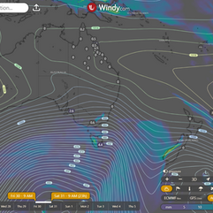
Windy.com NEW ACCESS 4 Day Accumulated Rain and Synoptic
Wednesday: expect things to be pretty clear and warmer than you'd expect for this time of year in most parts of the state. Some isolated showers might try to crash the party along the east coast north of Carmila, but they'll mainly hang out near the Cassowary and Daintree coasts, as well as the east Peninsula coast. Oh, and watch out for some scattered showers and potential thunderstorms in southeast Queensland, especially just a bit inland from the coast. Winds will be mainly coming from the east to northeast, keeping things breezy, although they might get a little indecisive down in the southwest.
Thursday: the state will be bathed in sunshine and unusually warm temperatures that will leave you questioning if it's really winter. Expect a slight chance of showers along the east coast above Carmila, with some areas like the Cassowary and Daintree coasts, as well as the east Peninsula coast, possibly seeing a bit more rain. It will be pleasantly toasty in the southern interior below Townsville and in the southeastern parts, while the rest of the state will be feeling above-average heat levels. So, get ready to sweat it out a bit more than usual!
Friday: It's gonna be like summer in winter for most of the state, folks! Picture this: the sun is shining bright and it's surprisingly warm out there. Don't forget your sunscreen! Expect a few isolated showers along the east coast above Proserpine, with a chance of scattered showers around the Cassowary and Daintree coasts, as well as the east Peninsula coast. Temps are hitting the roof in the south, especially below Townsville and down southeast – we're talking above average, even nearing record-breaking highs. It's gonna be a sizzlin' day, so stay cool out there!
Saturday: It's like someone turned up the heat in Queensland today! Expect plenty of sunshine and warmer-than-usual temperatures across the state. There might be a few isolated showers along the east coast north of Townsville to keep things interesting. The interior south of Townsville and the southeast are feeling the heat big time, with temperatures soaring well above average. In fact, some areas are even flirting with record-breaking daytime highs. Meanwhile, elsewhere in the state, temperatures are also on the warmer side. Stay cool, Queenslanders!coast above Proserpine, and around the Cassowary and Daintree coasts, as well as the east Peninsula coast. Temperatures are shooting up, especially south of Townsville and in the southeast - almost breaking records! Everywhere else is just feeling a bit above average.
State
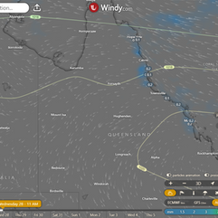
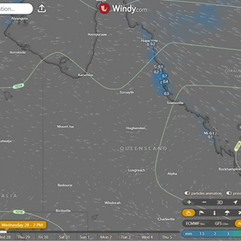
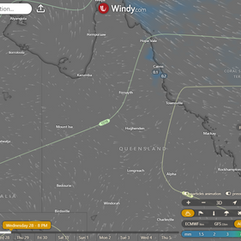
Windy.com ACCESS (Values are rainfall over 3 hours)
So, like, this big pressure system up north is like "Check me out!" and it's sending a fancy ridge over to the eastern side of the state. Then the system will be like, "Okay, gotta go east now." There's this trough thingy that's planning to swoop across the southern interior on Wednesday and then visit South East Queensland on Thursday. Another trough might make an appearance in the southwest by Friday and travel over the southern interior on Saturday, eventually reaching South East Queensland on Sunday. And get this – there will be these winds coming from the north before each trough arrives, which will keep things unusually warm across most of the state for the next week.
Min - Max - Rain
Regional Round-Up
North Tropical Coast and Tablelands:
Partly cloudy with some wannabe shower stars near the coast but only a sprinkle of hope elsewhere. Wind is feeling a bit indecisive, blowing from the east to southeasterly direction at 20-30 km/h. Overnight, temperatures are planning a cool party between 13-20°C, while the daytime highs are aiming for a toasty range of 23-29°C. Pack your bag with an umbrella and sunscreen, just in case Mother Nature decides to throw a surprise party!
Herbert and Lower Burdekin:
Expect a mix of sun and clouds with a side of fog in the morning; pack your detective hat for spotting the elusive shower lurking in the north (and nowhere else). Winds will make a graceful ballet from light to east-northeast at 15-20 km/h, before ending the day with a light breeze. Nighttime will be comfortably cool between 13-17, while daytime will hit a toasty 30; overall, a weather report as unpredictable as a game of musical chairs at a sloth convention.
Central Coast and Whitsundays:
Expect a mixed bag of weather tomorrow, with part clouds and a side of fog in the morning — a rarity for the adventurous fog enthusiasts out there. A sprinkle of rain may make an appearance in the morning, so pack your trusty umbrella just in case. The winds will play a delicate balancing act, starting light, then showing off their easterly flair at 15 to 20 km/h in the morning, only to calm down by the late evening. As the night falls, temperatures will drop to a comfy 13 to 17 while daytime temperatures will soar to a sunny 25 to 30. Remember, it's not just "weather", it's a performance art.
Peninsula:
Overall, expect partly cloudy skies with a moderate chance of showers along the east coast but next to no chance elsewhere. Prepare for easterly winds clocking in at 15 to 20 km/h, which will later pick up to 20 to 30 km/h. Grab your jackets as overnight temperatures will dip to 15-21 degrees, while daytime temperatures will soar to a toasty 30-35 degrees. Keep an eye out for those sassy easterly winds as they ramp up throughout the morning.
Gulf Country:
Bright and sunny skies ahead as light winds shift playfully from the northeast to southeasterly at 15 to 25 km/h before taking a leisurely break in the evening; temperatures take a dramatic plunge overnight to a cozy 15-19 degrees, only to skyrocket during the day to the charming low to mid 30s -- make sure to pack your sunscreen and shades for this fabulous weather forecast!
Northern Goldfields and Upper Flinders:
Expect a sunny day with a touch of fog in the early morning, especially in the southeast. Wind direction will be easterly to northeasterly at 15 to 25 km/h, so hold onto your hats! Temperatures will dip to a pleasant 12-15 degrees overnight, but brace yourself for a toasty 29-35 degrees during the day. Keep an eye out for any unexpected rain showers—Mother Nature loves surprises!
Capricornia:
Partly cloudy with a side of morning fog, a sprinkle of showers near the coast, and a whole lot of dry everywhere else. Light breezes to keep things interesting as temperatures dip down to 12-16°C overnight, only to climb back up to a toasty 30°C during the day.
Central Highlands and Coalfields:
Get ready to rise and shine through the fog in the early morning, only to be greeted by a sunny day ahead with light winds making it a pleasant experience. While overnight temperatures may dip to around 12 degrees, brace yourself for a toasty 30-degree daytime high - perfect for soaking up some Vitamin D!
Central West:
Get ready to sweat in the sunshine with northeasterly winds of 15 to 20 km/h, weakening in the AM then picking up an easterly to northeasterly flow of 15 to 20 km/h. Overnight, temperatures drop to a cool 12-15°C, while daytime highs soar to the scorching low to mid 30s. Say hello to a warm day with a side of breezy conditions and don't forget your sunscreen!
North West:
Tomorrow's forecast: It's going to be a scorcher! 🌞 With a shift in winds playing musical chairs from east to southeasterly to northeasterly, now that's a game of tag! Expect temps to plummet overnight to a balmy 13-18°C and then soar into the mid to high 30s during the day - better pack some ice packs! 💨 Keep an eye out for those gusts ranging between 15-25 km/h, just to keep things interesting. And the cherry on top? No rain in sight to cool things down. Stay hydrated! 💧🔥
Channel Country:
Get ready to bask in the sun with daytime temperatures in the low to mid 30s, accompanied by light winds transitioning from northwest to southwesterly at 20 to 30 km/h before calming down in the evening, while overnight temperatures dip to a cozy 12 to 16 degrees. Make sure to stay hydrated as there's no rain in sight, just clear skies and sunshine ahead!
Maranoa and Warrego:
Expect a heatwave in the making with scorching temperatures reaching the low to mid 30s during the day but cooling down to a balmy 13-17 degrees overnight. Hold onto your hats as strong north to northwesterly winds at 25-35 km/h will be shaking things up, before taking a mellow turn to the west and northwest in the afternoon. As the day winds down, the winds will also wind down, becoming light in the evening, leaving you to bask in the warmth of the day. Oh, and looks like it's going to be sunny - surprise, surprise!
Darling Downs and Granite Belt:
Expect a sunny day with a touch of whimsical wind ballet from the north to northwesterly at 25 to 35 km/h that later transitions to a daintier west to northwesterly in the day, offering a charming light breeze by evening. Overnight cuddle with temperatures between 12 and 16, while daytime reaches the low 30s for a warm embrace. Rainfall stays on vacation, making it a dry affair.
Wide Bay and Burnett:
Watch out for morning fog, but don't worry - the sun will come out to play in the afternoon. Winds will start off light, do a little dance to the north, and then calm down by the evening. Temperatures will cool down at night (11-15°C) and warm up during the day (around 30°C). Rainfall? Nope, not today - just good ol' sunshine waiting for you.
Southeast Coast:
Early morning fog may make you feel like you're in a scene from a mystery novel. But fear not, a bright and sunny day awaits, with gentle winds starting your morning and turning playful by the afternoon. Temperatures will drop overnight to a cozy 15°C before climbing to a toasty 28-33°C during the day, reminding you of a never-ending summer vacation.
Click here to support to Wally's Weather
National maps by Weatherzone (weatherzone.com.au)
State maps by Windy (Windy.com)
Weather forecast supplemented by Bureau of Meteorology (bom.gov.au)
Rainfall daily totals (https://meteologix.com/ )
AccuWeather (https://www.accuweather.com/)
Nine Weather (https://www.9news.com.au/weather)
Wally's Weather provides professionally researched data and information. Andrew aka 'Wally' has over 20 years of experience in meteorology research and data analysis. In 2023 finished top 4 for the AMOS national weather forecasting competition. The content here is provided as educational information aimed at providing the community and businesses with the tools required to determine local-based forecasts. IMPORTANT: The forecasts and information posted should never be used on their own to make business decisions as local influences.










Comments