To get your daily forecast delivered free goto http://wallysweather.com.au/blog

Your business could be going here!
Main Sponsorship to go here for Daily Available, email wallysweatheraustralia@gmail.com for details.
We have an August/September special on with the rest of July free.
National - Warnings - 4 Day - State - Min-Max-Rain - Regional Round-Up
National
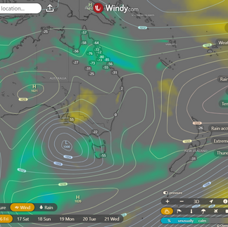
A low, a trough, and a front walk into a bar... and promptly bring showers, storms, and brisk winds to SA, TAS, VIC, and NSW. Meanwhile, over in southwest WA, some frisky, unstable winds are stirring up gusty showers and storms ahead of a cold front. But don't worry—high pressure is playing the bouncer, keeping things clear and dry everywhere else.
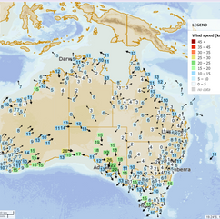
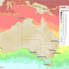
Synoptic | Temp/Rain | Wind | Sea Surface Temp
National Warnings
SA: Sheep Graziers Warning for Mount Lofty Ranges
VIC: Strong Wind Warning for Port Phillip
TAS: Strong Wind Warning for Far North West Coast
SA: Strong Wind Warning for Spencer Gulf & Far West, Upper West, Lower West, and Central coasts
QLD: Minor Flood Warning for the Burnett River
NSW/ACT: Gale Warning for Southern Area
NSW/ACT: Gale Warning for Western and Southern Areas
QLD: Final Flood Watch for South East Queensland Coastal Catchments
QLD: Initial Minor Flood Warning for the Mary River
QLD: Final Flood Warning for the Kolan River and Baffle Creek
WA: Gale Warning for Esperance and Eucla coasts, Strong Wind Warning for Leeuwin and Albany coasts
QLD: Final Flood Warning for the Burrum and Cherwell Rivers Catchments
NSW/ACT: Final Flood Watch for parts of the Northern Rivers
NSW/ACT: Cancelled Road Weather Alert for Canberra
NSW/ACT: Final Flood Warning for the Orara River
NSW/ACT: Final Flood Warning for the Wilsons River
NSW/ACT: Minor Flood Warning for the Lachlan River
WINDY.COM Extreme Weather
The 4 day forecast brought to you by our local businesses, you could have this spot with your details, support local, take out a Bold Shout ! $250 for a year, you get this and the website every day!
National 4 Day Forecast
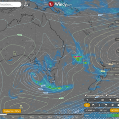
Windy.com ACCESS 4 Day 2PM Rain and Synoptic
Friday: Southeast Queensland will have isolated to scattered showers, while the Torres Strait enjoys its own sprinkle. The rest of the state? Mostly clear skies. Winds will be light to moderate from the northeast to southeast over northern Cape York Peninsula, with light and variable breezes elsewhere.
Saturday: Expect showers north of Lockhart River, sunshine for the rest, and a chance of morning fog south of Ingham. Gusty westerly winds will keep southeast Queensland on its toes. Temperatures will be near average in the far southwest, and above average everywhere else.
Sunday: More showers north of Lockhart River, but sunshine dominates elsewhere. Moderate to fresh winds will sweep through southeast Queensland. Temperatures will hover near average south of Longreach, but the rest of the state will feel the warmth above average.
Monday: Cape York Peninsula will see some spotty showers, with a few along the east coast too. The southwest will bask in the sun, though frost may nip the south. Temperatures will be near or above average, making it a cozy start to the week.
State
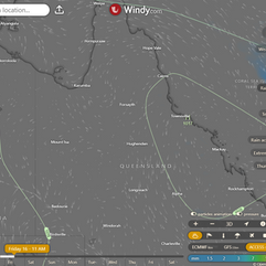
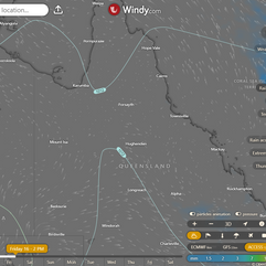
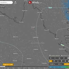
Windy.com ACCESS (Values are rainfall over 3 hours)
A weak ridge is hanging out over the state, while a low decides to head south on Friday, taking a dip into the Tasman Sea. By Saturday, that low is flexing its muscles, kicking up the winds over the southeast before it heads further east on Sunday. Meanwhile, a laid-back trough will be chilling across Queensland on Saturday. A high from the Southern Ocean will extend a weak ridge over the state from Sunday through Tuesday, bringing some onshore winds along for the ride. On Tuesday, that high starts wandering northeast into the Tasman Sea, drifting east from Wednesday, but keeping the ridge in check as it goes.
Min - Max - Rain
Regional Round-Up
North Tropical Coast and Tablelands: Expect a game of hide-and-seek with some morning fog, but the sun will win by afternoon. Light winds will flirt between northeast and southeast at 15 to 20 km/h in the afternoon, then mellow out by evening. Temperatures will cozy up between 11 and 17°C overnight, and warm up to 25-31°C during the day. No rain, just sunshine!
Herbert and Lower Burdekin: A perfect day for outdoor plans! Morning fog might make a brief appearance, but it'll clear up for a sunny afternoon. Light winds and temperatures lounging around 30°C, with the night cooling down between 12 and 16°C. No need to worry about rain.
Central Coast and Whitsundays: Morning fog might try to sneak in, but it’ll be gone before you know it, leaving behind a sunny day. Light winds, with overnight temps between 12 and 15°C, and daytime highs in the mid to high 20s. No rain in sight.
Peninsula: The weather is on its best behavior with max temps in the low to mid-30s. Light winds will shift to easterly at 15 to 20 km/h in the morning. Early risers in the east might spot some fog before it clears for a sunny day. Overnight temps dip to 14-19°C, and no rain is invited to this party.
Gulf Country: It’s all sunshine and good vibes here. Light winds, with temps dropping to 12-16°C overnight and climbing to the low to mid-30s during the day. The forecast doesn’t mention rain, so it’s just you, the sun, and maybe a cool breeze.
Northern Goldfields and Upper Flinders: Expect a sunny day with a side of patchy early morning fog in the southeast. Light winds will keep things calm, with daytime temps around 30°C and nighttime lows between 11 and 14°C. No rain, just clear skies.
Capricornia: Mostly sunny with a sprinkle of morning fog. There’s a slight chance of a shower in the southwest, but everywhere else should stay dry. Light winds with overnight temps between 11-15°C, and daytime temps in the mid to high 20s.
Central Highlands and Coalfields: Expect a mostly sunny day with patchy morning fog. A slight chance of a shower in the southeast, but otherwise dry. Light winds, with overnight temps falling to around 12°C and daytime highs in the mid to high 20s.
Central West: The sun’s taking center stage today with light winds turning westerly at 15 to 20 km/h. Temperatures will range from a brisk 9°C in the morning to a warm 30°C by afternoon. No rain to rain on your parade.
North West: Tomorrow’s looking bright and sunny with daytime temps reaching the low 30s and overnight lows between 9 and 13°C. Light winds and no rain mean it’s a great day to get outside.
Channel Country: The day will be sunny with max temps around 30°C and a cool start at around 11°C. Winds will pick up, turning northwest to northeasterly at 20 to 30 km/h in the morning, then switching to northwest to southwesterly at 25 to 35 km/h by midday. No rain is expected, so enjoy the sunshine.
Maranoa and Warrego: Expect a mostly sunny day with some patchy morning fog. There’s a slight chance of a shower in the southeast, but it should stay dry elsewhere. Light winds will pick up to west-northwesterly at 15-25 km/h. Overnight temps around 10°C, with daytime highs in the mid to high 20s.
Darling Downs and Granite Belt: The weather’s serving up a mix of sun and patchy morning fog, with a slight chance of showers in the morning. Light winds will become west-northwesterly at 15 to 20 km/h. Temperatures will hover in the low to mid-20s during the day, with overnight lows around 11°C.
Wide Bay and Burnett: Temperatures will reach the mid to high 20s during the day, with lows between 11 and 15°C at night. Light winds will keep things breezy. Expect some patchy morning fog and maybe a slight chance of a shower in the late morning, but the afternoon will be mostly sunny.
Southeast Coast: It’s a classic day with highs in the low to high 20s, lows between 12 and 15°C, and light winds becoming west-northwesterly at 15-20 km/h. There’s a slight chance of a shower late in the morning, with some patchy fog in the early hours. But don’t worry, the sun will shine bright in the afternoon.
Click here to support to Wally's Weather
National maps by Weatherzone (weatherzone.com.au)
State maps by Windy (Windy.com)
Weather forecast supplemented by Bureau of Meteorology (bom.gov.au)
Rainfall daily totals (https://meteologix.com/ )
AccuWeather (https://www.accuweather.com/)
Nine Weather (https://www.9news.com.au/weather)
Wally's Weather provides professionally researched data and information. Andrew aka 'Wally' has over 20 years of experience in meteorology research and data analysis. In 2023 finished top 4 for the AMOS national weather forecasting competition. The content here is provided as educational information aimed at providing the community and businesses with the tools required to determine local-based forecasts. IMPORTANT: The forecasts and information posted should never be used on their own to make business decisions as local influences.













Comments