January 29 we picked up on a potential system near Broome and another near the Peninsula in the gulf. And the dates would be about the 13th Feb. And the BOM now have 07U.
16.2.24
TC Lincoln called today

Headline:
Tropical Cyclone Lincoln now just inland of southern Gulf of Carpentaria coast between Borroloola and the NT/Qld Border. To weaken tonight and move west across NT this weekend.
Areas affected:
Warning zone: Bing Bong (NT) to NT/Qld Border, including Borroloola and Port McArthur .
Watch zone: None.
Cancelled zones: None.
Details of Tropical Cyclone Lincoln at 6:30 pm ACST:
Intensity: category 1, sustained winds near the centre of 75 kilometres per hour with wind gusts to 100 kilometres per hour.
Location: within 30 kilometres of 16.3 degrees South, 137.1 degrees East , 90 kilometres east southeast of Borroloola and 225 kilometres west of Mornington Island .
Movement: south southwest at 12 kilometres per hour .
Tropical Cyclone Lincoln has crossed the coast and will weaken below tropical cyclone intensity tonight. Lincoln will then move west across the central Northern Territory during the weekend and into the Kimberly on Monday.
Hazards:
GALES with DAMAGING WIND GUSTS to 90 kilometres per hour are occurring along the coast between Bing Bong and NT/Qld Border but should ease tonight.
HEAVY RAINFALL is expected along the southern Gulf of Carpentaria coast with LOCALLY INTENSE RAINFALL possible around Lincoln's centre. Refer to separate Flood watches and warnings, as well as the Severe Weather Warning.
Tides will be HIGHER THAN NORMAL across the southern Gulf of Carpentaria tonight and Saturday.
14.2.24
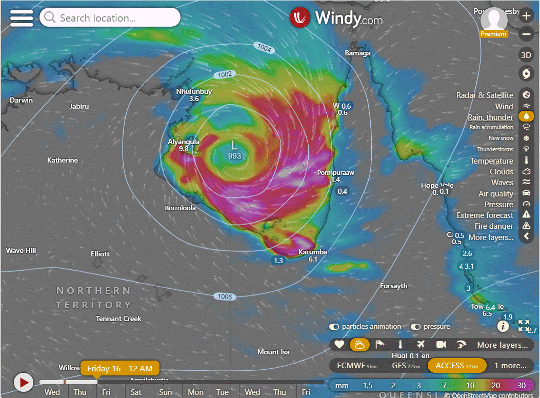
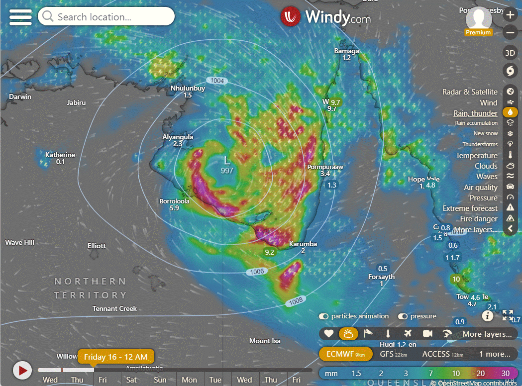
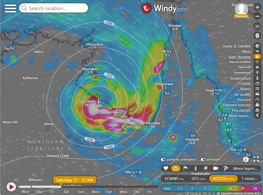
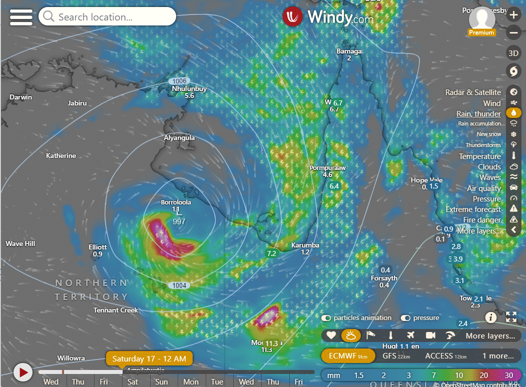
With 07U/93S has moved into the Gulf and now the finer movements are crucial to determine if it will have enough time to deepen into a tropical cyclone, and if it will produce much rain for the NQ coastline. It appears that neither is likely at this stage, but a delay and continued movement to the ENE could improve those chances. ACCESS is very confident of a lot of rain for the Gulf, to a lesser extent the GFS and slightly more optimistic is the EC model. The next day is shown on the bottom row. As you can see its looking like a fast exit of the Gulf. Not huge amounts for the NQ coast but some rain will be welcome.
The system is about 775 kilometers east-southeast of Darwin. Looking at satellite images, we see developing groups of storms and a growing circular motion near the surface.
The conditions around this area suggest it could become a stronger weather system. The sea is very warm (30-31°C), and there's good airflow in the upper atmosphere. The winds higher up are also not too strong, making it favorable for development. The weather models agree that, in the next 12 hours, the storm will generally move eastward over the southern Gulf of Carpentaria. After that, within the next 24-36 hours, it is expected to turn southward toward the land.
The strongest winds within the storm are estimated to be between 23 to 28 knots. The minimum air pressure at sea level is estimated to be around 1003 millibars (hPa). There's a medium chance that this weather system could develop into a significant tropical cyclone within the next 24 hours.
10.2.24
4 days out the alignment is good but not great. Clear feed from the equator and current air flowing to the East above Darwin and West to the South of Katherine. This will eventually rotate around the pressure system.
Tropical Low 07U
Moderate risk of a tropical cyclone over Gulf of Carpentaria late in the week.
Tropical low 07U is forecast to form Monday or Tuesday over northern Australia, most likely in the vicinity of the Joseph Bonaparte Gulf.
Mid-week the system is likely to move eastwards towards the Gulf of Carpentaria.
There is a Low risk of 07U developing into a tropical cyclone in the Gulf of Carpentaria from Wednesday increasing to a Moderate (30%) risk on Friday.
Last updated
5 hours ago, 09:30 am AEST

Currently barely a cloud.


Comments